Latitude: 51.6379 / 51°38'16"N
Longitude: -1.0269 / 1°1'36"W
OS Eastings: 467440
OS Northings: 193679
OS Grid: SU674936
Mapcode National: GBR B23.C5W
Mapcode Global: VHDW0.43Z7
Plus Code: 9C3WJXQF+56
Entry Name: Church of St Nicholas
Listing Date: 11 December 1985
Grade: II
Source: Historic England
Source ID: 1059466
English Heritage Legacy ID: 247480
Also known as: Church of St Nicholas, Britwell Salome
ID on this website: 101059466
Location: St Nicholas's Church, Britwell Salome, South Oxfordshire, OX49
County: Oxfordshire
District: South Oxfordshire
Civil Parish: Britwell Salome
Traditional County: Oxfordshire
Lieutenancy Area (Ceremonial County): Oxfordshire
Church of England Parish: Britwell Salome
Church of England Diocese: Oxford
Tagged with: Church building
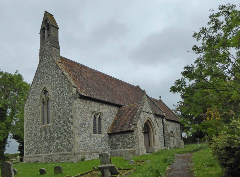
BRITWELL SU6793 8/9 Church of St. Nicholas
GV II
Church. Early C12; rebuilt 1867 by Charles Buckeridge. Flint rubble, limestone ashlar dressings; gabled old tile roof. Chancel, vestry, nave and west bellcote. Late C13 style 3-light east window. South chancel wall has trefoil-headed lights flanking Norman doorway: billeted round arch of 2 orders with scalloped capitals to engaged shafts. Lean-to north vestry has Early English lancet. Nave has 2-light ogee-headed windows: south gabled porch with pointed moulded doorway to pointed chamfered south doorway with plank door. Interior: chancel has C18 and C19 wall tablets and brass to John Mores, d.1492. Nave has mid C19 wood pulpit on stone base, lectern and pews; C13 cup-shaped font with fine early C17 ogee-shaped cover. Mid C19 roof. (Buildings of England: Oxfordshire, p.486; V.C.H.: Oxfordshire, Vol.VIII, p.50).
Listing NGR: SU6744093679
External links are from the relevant listing authority and, where applicable, Wikidata. Wikidata IDs may be related buildings as well as this specific building. If you want to add or update a link, you will need to do so by editing the Wikidata entry.


Other nearby listed buildings