Latitude: 51.6331 / 51°37'59"N
Longitude: -1.0318 / 1°1'54"W
OS Eastings: 467105
OS Northings: 193143
OS Grid: SU671931
Mapcode National: GBR B23.HYH
Mapcode Global: VHDW0.26CX
Plus Code: 9C3WJXM9+67
Entry Name: The Old Farmhouse
Listing Date: 11 December 1985
Grade: II
Source: Historic England
Source ID: 1059473
English Heritage Legacy ID: 247498
ID on this website: 101059473
Location: Britwell Salome, South Oxfordshire, OX49
County: Oxfordshire
District: South Oxfordshire
Civil Parish: Britwell Salome
Traditional County: Oxfordshire
Lieutenancy Area (Ceremonial County): Oxfordshire
Church of England Parish: Britwell Salome
Church of England Diocese: Oxford
Tagged with: Farmhouse
BRITWELL BRITWELL HILL R0A0 SU6793 (West side) 8/27 The Old Farmhouse
GV II
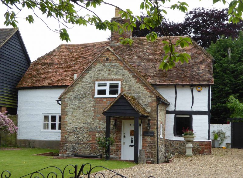
Shown on 0.S. map as Britwell Old Farmhouse. Farmhouse. Dated 1668, remodelled and extended in early/mid C18. Rectangular timber framing with colourwashed brick infill to right; colourwashed early/mid C18 brick to left; half-hipped old tile roof; brick ridge stack. 2-unit lobby-entry plan. 2 storeys; 3-window range. Early/mid C18 two-storey gabled porch of chalk rubble with brick dressings and C20 door. Late C19 three-light casement to left, C20 casement to right. Early/mid C18 one-bay wing to rear right of one storey and attic: colourwashed brick and chalkrubble, gabled old tile roof, brick end stack. Interior: ogee-stopped beams and open fireplaces with bread oven. Date l668/JBH (John and Mary Baker) inscribed on plasterwork over first-floor left fireplace.
Listing NGR: SU6710593143
External links are from the relevant listing authority and, where applicable, Wikidata. Wikidata IDs may be related buildings as well as this specific building. If you want to add or update a link, you will need to do so by editing the Wikidata entry.


Other nearby listed buildings