Latitude: 51.7045 / 51°42'16"N
Longitude: -0.9898 / 0°59'23"W
OS Eastings: 469905
OS Northings: 201123
OS Grid: SP699011
Mapcode National: GBR B1D.2L1
Mapcode Global: VHDVM.SFL5
Plus Code: 9C3XP236+R3
Entry Name: Attington Toll House
Listing Date: 5 August 1987
Grade: II
Source: Historic England
Source ID: 1059661
English Heritage Legacy ID: 249119
ID on this website: 101059661
Location: South Oxfordshire, OX9
County: Oxfordshire
District: South Oxfordshire
Civil Parish: Tetsworth
Traditional County: Oxfordshire
Lieutenancy Area (Ceremonial County): Oxfordshire
Church of England Parish: Tetsworth
Church of England Diocese: Oxford
Tagged with: House
TETSWORTH B4012 SP60SE (West side) 2/105 Attington Toll House
- II
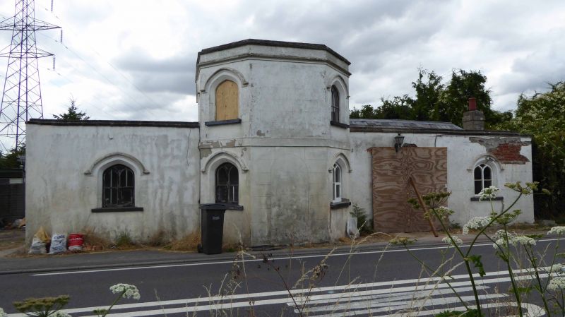
Toll house, now house. c.1770, erected for the Thame United Trust. Render, probably on brick; slate hipped roofs with lead ridges; rendered brick end stack to right, and to right of 2-storey portion. Gothick style. 2-storey octagonal portion with single-storey, single-bay wing to left. Further single-storey, 2-bay wing to right. Blocked doorway to centre of octagonal portion. 6-panel door with 4-centred arched head and hood mould to right of centre. Wood Y-tracery windows with 4-centred arched heads and hood moulds to all openings. Flat rendered band between ground and first floors of octagonal portion. Plain parapets to eaves. Interior not inspected. (Toll houses of Oxfordshire, Oxfordshire Museums Information Sheet 6).
Listing NGR: SP6990501123
External links are from the relevant listing authority and, where applicable, Wikidata. Wikidata IDs may be related buildings as well as this specific building. If you want to add or update a link, you will need to do so by editing the Wikidata entry.


Other nearby listed buildings