Latitude: 51.5918 / 51°35'30"N
Longitude: -1.2412 / 1°14'28"W
OS Eastings: 452661
OS Northings: 188381
OS Grid: SU526883
Mapcode National: GBR 912.50V
Mapcode Global: VHCYM.F8P1
Plus Code: 9C3WHQR5+PG
Entry Name: 10, the Croft
Listing Date: 12 June 1989
Grade: II
Source: Historic England
Source ID: 1059814
English Heritage Legacy ID: 248783
ID on this website: 101059814
Location: East Hagbourne, South Oxfordshire, OX11
County: Oxfordshire
District: South Oxfordshire
Civil Parish: East Hagbourne
Built-Up Area: Didcot
Traditional County: Berkshire
Lieutenancy Area (Ceremonial County): Oxfordshire
Church of England Parish: Hagbourne
Church of England Diocese: Oxford
Tagged with: Building
The following building shall be included:
EAST HAGBOURNE THE CROFT (South side) SU 5288 14/60 No. 10
GV II
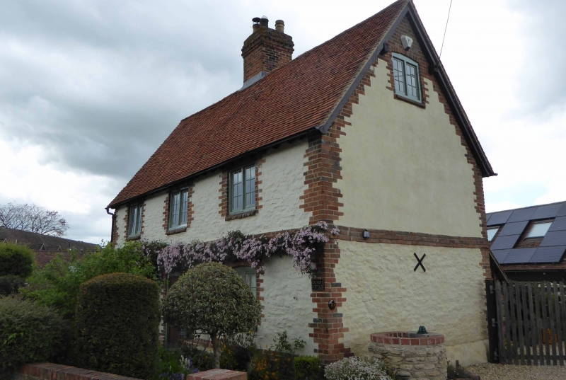
House. C18, probably early; altered C19 and early C20. Rubblestone with red brick dressings; brick addition. Plain tile roof. 2-cell lobby-entry plan with added rear outshut. 2 storeys with attic; 3 1st-floor windows. Brick plinth, quoins, quoined surrounds to openings and platt band. Windows (altered C19) are segmental-arched on ground floor, flat-arched above, with chamfered brick sills and small-pane 2-light casement windows. Central board door below segmental header-brick arch. Large brick central ridge stack. Rear: early C20 outshut addition not of special interest. Each return has gable of brick with 1 2-light attic window; wooden lean-to against left return not of special interest. Interior: chamfered spine-beams with stepped cyma stops; old board doors, right-hand ground-floor room has brick fireplace with timber lintel, mantleshelf and gun rack; wooden winder stair rises over entrance lobby; roof has 2 collars at centre supporting through purlins and pegged rafters.
Listing NGR: SU5266188381
External links are from the relevant listing authority and, where applicable, Wikidata. Wikidata IDs may be related buildings as well as this specific building. If you want to add or update a link, you will need to do so by editing the Wikidata entry.


Other nearby listed buildings