Latitude: 51.0126 / 51°0'45"N
Longitude: -3.1053 / 3°6'19"W
OS Eastings: 322556
OS Northings: 124271
OS Grid: ST225242
Mapcode National: GBR M1.JF3X
Mapcode Global: FRA 46DF.L1W
Plus Code: 9C3R2V7V+2V
Entry Name: 15, THE CRESCENT (See details for further address information)
Listing Date: 4 June 1952
Last Amended: 29 July 1970
Grade: II*
Source: Historic England
Source ID: 1060043
English Heritage Legacy ID: 269675
ID on this website: 101060043
Location: Taunton, Somerset, TA1
County: Somerset
District: Somerset West and Taunton
Electoral Ward/Division: Taunton Manor and Wilton
Parish: Taunton
Built-Up Area: Taunton
Traditional County: Somerset
Lieutenancy Area (Ceremonial County): Somerset
Tagged with: Building
THE CRESCENT 1. 5365 (East Side) 29.7.70. No 15 4.6.52. Nos 16 to 20 (consec) ST 2224 SE 11/39
II* GV
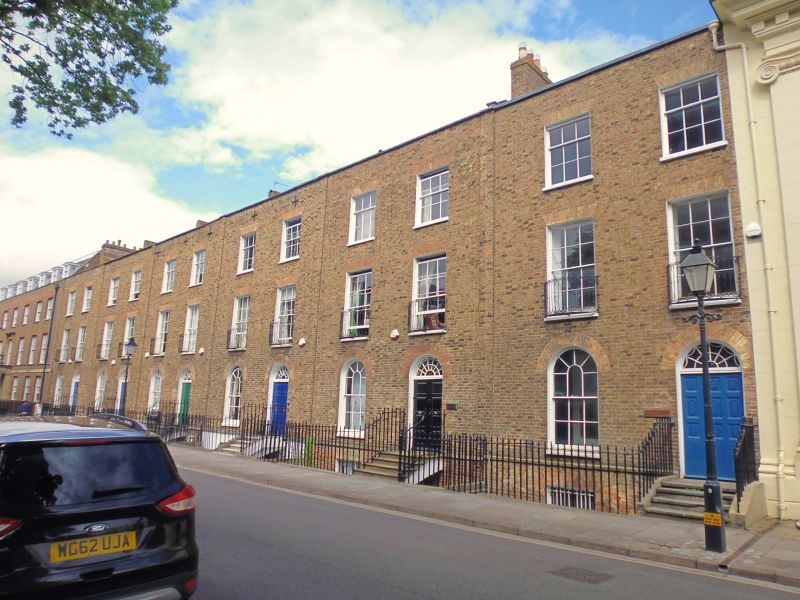
2. A further length of terrace built in 1807, now divided from Nos 1 to 11 (consec) but retaining some group value with the rest of the street. 3 storey plus basement houses in pinkish-brown brick. Plain pilasters divide the houses. Hipped slate roofs behind parapets, 2 windows per house, sashes with glazing bars, Round headed openings to ground floor. Segmental iron balconies to lst floor. Round headed doorways, traceried fanlights. 8-panel doors in 2 leaves. Attached railings to forecourts and franking basement steps.
All the Iisted buildings in the Crescent form a group with No 14 and Wall Bath Place and Dragon Book Shop, Corporation Street.
Listing NGR: ST2255624271
External links are from the relevant listing authority and, where applicable, Wikidata. Wikidata IDs may be related buildings as well as this specific building. If you want to add or update a link, you will need to do so by editing the Wikidata entry.


Other nearby listed buildings