Approximate Location Map
Large Map »
Latitude: 51.2434 / 51°14'36"N
Longitude: 0.4125 / 0°24'45"E
OS Eastings: 568488
OS Northings: 152126
OS Grid: TQ684521
Mapcode National: GBR NPY.WNH
Mapcode Global: VHJMK.30FM
Plus Code: 9F326CV7+92
Entry Name: Monument About 3 Metres West of Tower of Church of St Mary
Listing Date: 14 October 1987
Grade: II
Source: Historic England
Source ID: 1060647
English Heritage Legacy ID: 174806
ID on this website: 101060647
Location: St Mary's Church, Nettlestead, Maidstone, Kent, ME18
County: Kent
District: Maidstone
Civil Parish: Nettlestead
Traditional County: Kent
Lieutenancy Area (Ceremonial County): Kent
Church of England Parish: Nettlestead St Mary the Virgin
Church of England Diocese: Rochester
Tagged with: Chest tomb
NETTLESTEAD MAIDSTONE ROAD
TQ 65 SE
(East side)
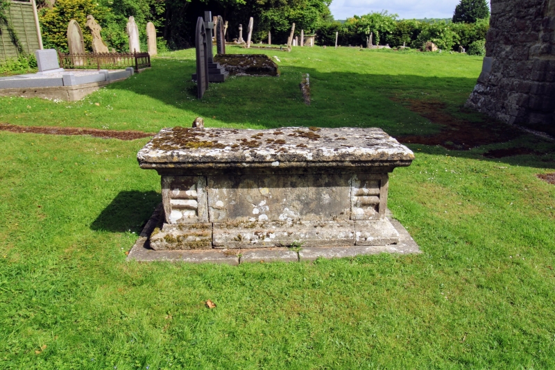
1/6 Monument about
3 metres west
of tower of
Church of
St. Mary
GV II
Chest tomb. Mid C18. Stone. Moulded plinth, lid and side panels.
Inscriptions barely legible at time of re-survey; south side to
John...... d.1762.
Listing NGR: TQ6854552056
External links are from the relevant listing authority and, where applicable, Wikidata. Wikidata IDs may be related buildings as well as this specific building. If you want to add or update a link, you will need to do so by editing the Wikidata entry.


Other nearby listed buildings
