Latitude: 51.0738 / 51°4'25"N
Longitude: 1.1501 / 1°9'0"E
OS Eastings: 620771
OS Northings: 135218
OS Grid: TR207352
Mapcode National: GBR V0P.PKP
Mapcode Global: FRA F698.V77
Plus Code: 9F3335F2+G3
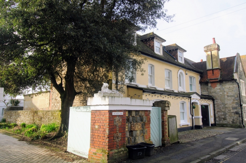
Entry Name: Gatepiers to the White Lodge
Listing Date: 3 December 1986
Grade: II
Source: Historic England
Source ID: 1061239
English Heritage Legacy ID: 175282
ID on this website: 101061239
Location: Sandgate, Folkestone and Hythe, Kent, CT20
County: Kent
District: Folkestone and Hythe
Civil Parish: Sandgate
Built-Up Area: Folkestone
Traditional County: Kent
Lieutenancy Area (Ceremonial County): Kent
Tagged with: Gatepost
1. 5281 CASTLE ROAD (South Side) SANDGATE Gatepiers to the White Lodge TR 2035 SE 7/66 II GV 2. 2 square piers of brick and stone surmounted by stone couchant figures of a lion and lioness.
No 2, Sandgate Castle, The Hermitage, York Cottage, Gatepiers to The White Lodge form a group with Nos 12 to 16 (even) and Gatenpiers to 12 to l6 (even). (No 2 and Nos 12 to 16 (even) and Gatepiers to Nos 12 to 16 (even) being buildings of local interest.
Listing NGR: TR2077135218
External links are from the relevant listing authority and, where applicable, Wikidata. Wikidata IDs may be related buildings as well as this specific building. If you want to add or update a link, you will need to do so by editing the Wikidata entry.


Other nearby listed buildings