Latitude: 52.7454 / 52°44'43"N
Longitude: -0.7835 / 0°47'0"W
OS Eastings: 482219
OS Northings: 317108
OS Grid: SK822171
Mapcode National: GBR CQK.SWN
Mapcode Global: WHFK7.Y835
Plus Code: 9C4XP6W8+4J
Entry Name: Slaughter House 25 Metres South East of Holygate Lodge
Listing Date: 7 January 1988
Grade: II
Source: Historic England
Source ID: 1061254
English Heritage Legacy ID: 189806
ID on this website: 101061254
Location: Melton, Leicestershire, LE14
County: Leicestershire
District: Melton
Civil Parish: Freeby
Traditional County: Leicestershire
Lieutenancy Area (Ceremonial County): Leicestershire
Church of England Parish: Saxby with Stapleford and Wyfordby
Church of England Diocese: Leicester
Tagged with: Building
SK 81 NW FREEBY HOLYGATE DRIVE
Stapleford Park (east side) 6/34 Slaughterhouse 25 M south-east of Holygate Lodge
G.V. II
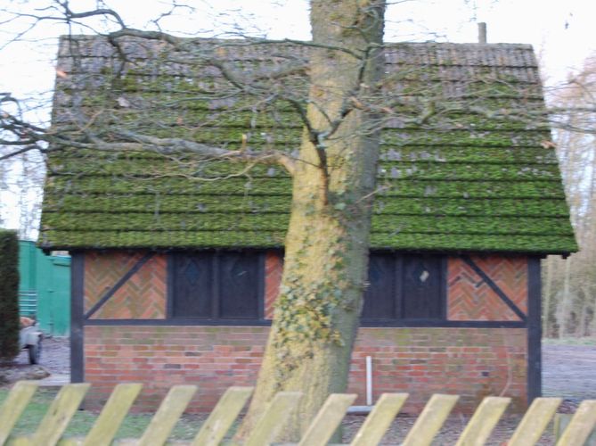
Slaughterhouse, now a workshop. Mid C19. Timber framed with brick nogging and concrete tile roofs. Single storey, single bay. The windows are single and double unglazed casements with shutters, each with a lozenge shaped cutout. North side has a central gabled porch with a 4 centred arched doorway and weatherstripped plank door. In each side, a single casement. Beyond, a single 2 light casement. Each gable end has a 2 light casement. South side has 2 two light casements. This building is one of the detached outbuildings of Stapleford Park. It was used for the slaughter of deer.
Listing NGR: SK8221917108
External links are from the relevant listing authority and, where applicable, Wikidata. Wikidata IDs may be related buildings as well as this specific building. If you want to add or update a link, you will need to do so by editing the Wikidata entry.


Other nearby listed buildings