Latitude: 52.705 / 52°42'18"N
Longitude: -0.969 / 0°58'8"W
OS Eastings: 469760
OS Northings: 312424
OS Grid: SK697124
Mapcode National: GBR BPK.FT9
Mapcode Global: WHFKC.28VM
Plus Code: 9C4XP24J+2C
Entry Name: Gaddesby Windmill
Listing Date: 7 January 1988
Grade: II
Source: Historic England
Source ID: 1061265
English Heritage Legacy ID: 189833
ID on this website: 101061265
Location: Ashby Folville, Melton, Leicestershire, LE7
County: Leicestershire
District: Melton
Civil Parish: Gaddesby
Traditional County: Leicestershire
Lieutenancy Area (Ceremonial County): Leicestershire
Church of England Parish: Ashby Folville (South Croxton Group)
Church of England Diocese: Leicester
SK 61 SE GADDESBY ASHBY ROAD
(north side) 8/76 Gaddesby Windmill
II
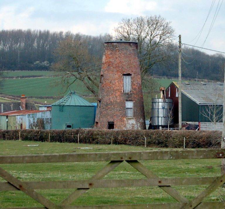
Windmill, now a cattle food store. Early C19, with mid and late C20 alterations. Brick with felted conical roof. Battered round tower of 4 stages. First stage has door to west, and windows to south-west and north-east. Second stage has blocked door to north and door to south. Windows to east and west, and blocked window to north-east. Third stage has door to south and windows and west and north-east. Fourth stage has blocked window to west. All openings have segmental heads. Interior has 2 floors without machinery or fittings.
Listing NGR: SK6976012424
External links are from the relevant listing authority and, where applicable, Wikidata. Wikidata IDs may be related buildings as well as this specific building. If you want to add or update a link, you will need to do so by editing the Wikidata entry.


Other nearby listed buildings