Approximate Location Map
Large Map »
Latitude: 53.4174 / 53°25'2"N
Longitude: -2.9699 / 2°58'11"W
OS Eastings: 335632
OS Northings: 391618
OS Grid: SJ356916
Mapcode National: GBR 77J.KY
Mapcode Global: WH877.BCZG
Plus Code: 9C5VC28J+X2
Entry Name: Former Lock Up
Listing Date: 14 March 1975
Grade: II
Source: Historic England
Source ID: 1062539
English Heritage Legacy ID: 359525
ID on this website: 101062539
Location: Brow Side Gardens, Everton, Liverpool, Merseyside, L5
County: Liverpool
Electoral Ward/Division: Everton
Parish: Non Civil Parish
Built-Up Area: Liverpool
Traditional County: Lancashire
Lieutenancy Area (Ceremonial County): Merseyside
Church of England Parish: Everton St Peter
Church of England Diocese: Liverpool
Tagged with: Tower
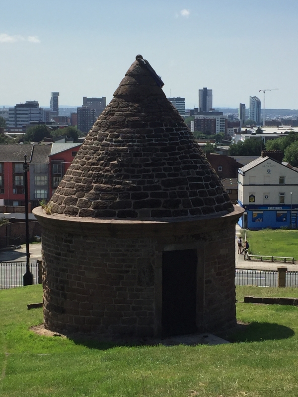
SJ 3591 SHAW STREET
L5
23/1154 Former lock-up
14.3.75.
G.V. II
1787. Red sandstone building in form of a round drum with
conical roof. Now in public garden.
Listing NGR: SJ3563291618
External links are from the relevant listing authority and, where applicable, Wikidata. Wikidata IDs may be related buildings as well as this specific building. If you want to add or update a link, you will need to do so by editing the Wikidata entry.


Other nearby listed buildings
