Latitude: 52.6536 / 52°39'13"N
Longitude: -0.4754 / 0°28'31"W
OS Eastings: 503228
OS Northings: 307302
OS Grid: TF032073
Mapcode National: GBR FVS.LMY
Mapcode Global: WHGLX.NKTJ
Plus Code: 9C4XMG3F+FR
Entry Name: 12, St Paul's Street
Listing Date: 22 May 1954
Grade: II*
Source: Historic England
Source ID: 1062942
English Heritage Legacy ID: 193778
ID on this website: 101062942
Location: Stamford, South Kesteven, Lincolnshire, PE9
County: Lincolnshire
District: South Kesteven
Civil Parish: Stamford
Built-Up Area: Stamford
Traditional County: Lincolnshire
Lieutenancy Area (Ceremonial County): Lincolnshire
Church of England Parish: Stamford St George
Church of England Diocese: Lincoln
Tagged with: Building
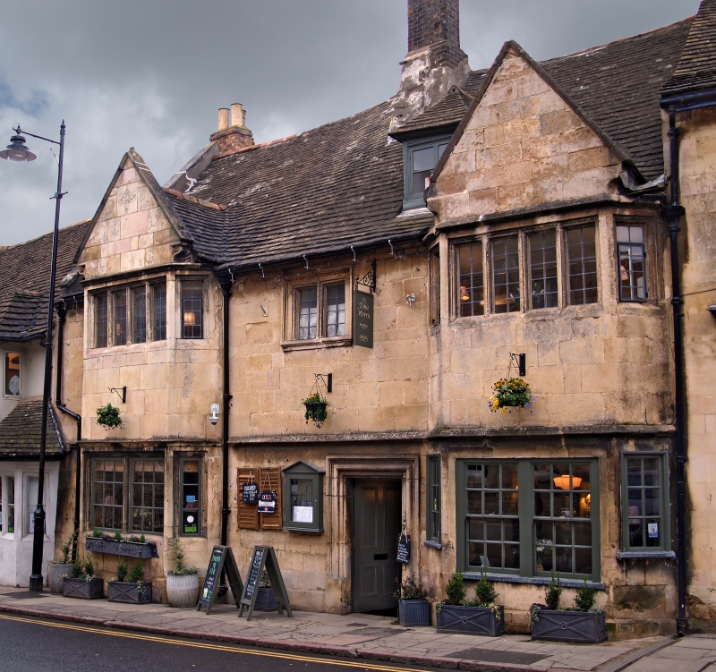
1. 1671 ST PAUL'S STREET (North Side) No 12 TF 0307 1/296 22.5.54. II* GV 2. Almost untouched C17 front in ashlar. 2 storeys. 2 2-storey canted bays, gabled, with an upper window in each of 6 mullioned lights, with leaded casements. Lower windows have glazing-barred hung sashes, inserted into earlier openings, of which 3 mullions survive. Moulded strings, that on the East gable of slightly different section. The upper follows the lintel of the windows. Moulded brackets at end of gables, and a damaged stone finial at either end. One hipped dormer with leaded casement. One small 2-light mullioned window in centre with moulded architrave and cill. Door of 4 panels set in fine rectangular frame with bolection mould. Moulded stone plinth. West gable contains date stone inscribed:- "NTS 1663". Iron scraper.
Nos 7 to 17 (consec) form a group.
Listing NGR: TF0322807302
External links are from the relevant listing authority and, where applicable, Wikidata. Wikidata IDs may be related buildings as well as this specific building. If you want to add or update a link, you will need to do so by editing the Wikidata entry.


Other nearby listed buildings