Latitude: 53.3872 / 53°23'13"N
Longitude: -2.9463 / 2°56'46"W
OS Eastings: 337156
OS Northings: 388231
OS Grid: SJ371882
Mapcode National: GBR 7DW.MS
Mapcode Global: WH87F.Q455
Plus Code: 9C5V93P3+VF
Entry Name: 38, Ullet Road
Listing Date: 19 June 1985
Grade: II
Source: Historic England
Source ID: 1063277
English Heritage Legacy ID: 359635
ID on this website: 101063277
Location: Princes Park, Liverpool, Merseyside, L17
County: Liverpool
Electoral Ward/Division: Greenbank
Parish: Non Civil Parish
Built-Up Area: Liverpool
Traditional County: Lancashire
Lieutenancy Area (Ceremonial County): Merseyside
Church of England Parish: Toxteth Park Christ Church
Church of England Diocese: Liverpool
Tagged with: Building
SJ 3788 ULLET ROAD (south side) L17
33/1255 No.38 -
G.V. II
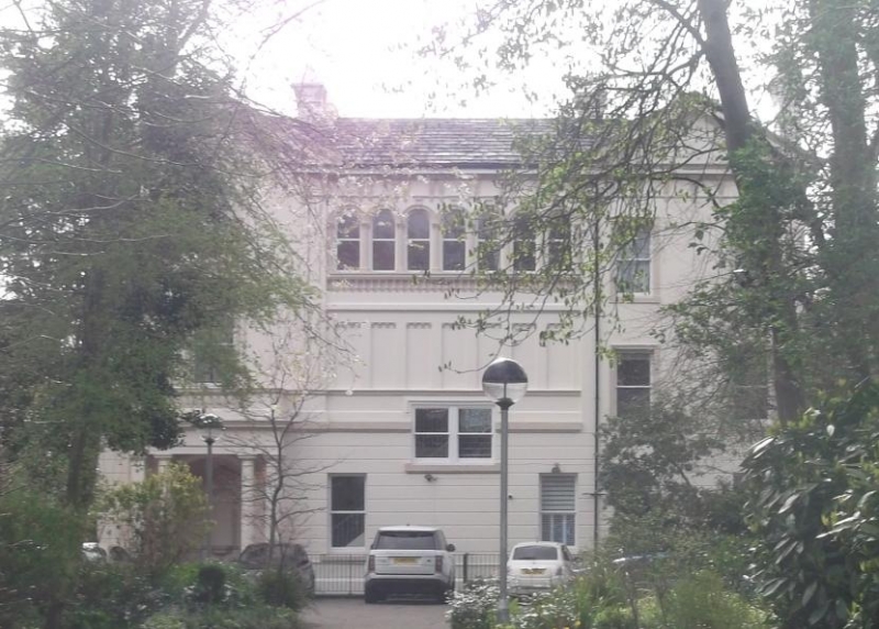
House. 1860s. Stucco with slate roof. 4 storeys, 3 bays. Ground floor has channelled rustication with band over. 1st floor sill course and top consoled cornice. Ground floor has 2 windows to 2nd bay with mezzanine window with label mould above. 1st floor 1st bay window has segmental head with architrave, frieze and consoled pediment. 2nd bay has 7 recessed panels with top corbel tables and band over; one inserted window. End 2 bays have windows in architraves. 2nd floor 1st bay has round-headed window in architrave, with open pediment over. 2nd bay has window of 7 round-headed lights . End 2 bays have windows as 1st floor and pediment. Entrance has porch with distyle-in-antis Doric colonnade and balustraded balcony to window above. Niche behind, and entrance in return. Rear is similar, with 2-storey central bow.
Listing NGR: SJ3715688231
External links are from the relevant listing authority and, where applicable, Wikidata. Wikidata IDs may be related buildings as well as this specific building. If you want to add or update a link, you will need to do so by editing the Wikidata entry.


Other nearby listed buildings