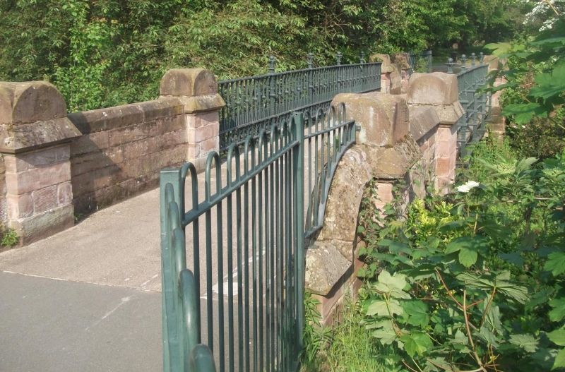
Latitude: 53.4365 / 53°26'11"N
Longitude: -2.9621 / 2°57'43"W
OS Eastings: 336180
OS Northings: 393735
OS Grid: SJ361937
Mapcode National: GBR 79B.73
Mapcode Global: WH871.GWPC
Plus Code: 9C5VC2PQ+J5
Entry Name: Bridge to East of Pavilion
Listing Date: 14 March 1975
Grade: II
Source: Historic England
Source ID: 1063334
English Heritage Legacy ID: 359583
ID on this website: 101063334
Location: Stanley Park, Anfield, Liverpool, Merseyside, L4
County: Liverpool
Electoral Ward/Division: Anfield
Parish: Non Civil Parish
Built-Up Area: Liverpool
Traditional County: Lancashire
Lieutenancy Area (Ceremonial County): Merseyside
Church of England Parish: Walton Breck Christ Church and Holy Trinity
Church of England Diocese: Liverpool
Tagged with: Bridge
SJ 39 SE STANLEY PARK L4
4/1207 Bridge to east of pavilion 14.3.75. G.V. II
Bridge. c.1870. E. R. Robson. Iron girders support iron railings, stone piers at ends. Space below bridge now filled in (1984).
Listing NGR: SJ3618093735
External links are from the relevant listing authority and, where applicable, Wikidata. Wikidata IDs may be related buildings as well as this specific building. If you want to add or update a link, you will need to do so by editing the Wikidata entry.


Other nearby listed buildings