Latitude: 52.4434 / 52°26'36"N
Longitude: -2.0449 / 2°2'41"W
OS Eastings: 397044
OS Northings: 282821
OS Grid: SO970828
Mapcode National: GBR 2DL.ZRB
Mapcode Global: VH9Z0.HVS9
Plus Code: 9C4VCXV4+82
Entry Name: The Grange
Listing Date: 10 January 1950
Grade: II*
Source: Historic England
Source ID: 1063763
English Heritage Legacy ID: 359801
ID on this website: 101063763
Location: Dudley, West Midlands, B62
County: Dudley
Electoral Ward/Division: Halesowen South
Parish: Non Civil Parish
Built-Up Area: Halesowen
Traditional County: Worcestershire
Lieutenancy Area (Ceremonial County): West Midlands
Church of England Parish: Halas
Church of England Diocese: Worcester
Tagged with: Building
1. 5106 GRANGE ROAD ----------- The Grange SO 98 SE 2/42 10.1.50.
II*
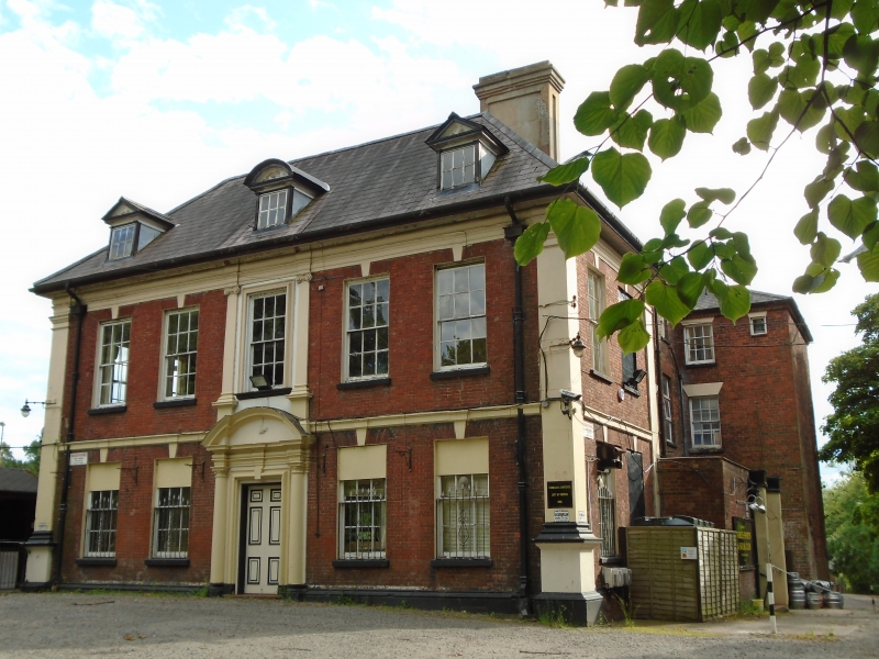
2. Early-mid C18, the south facade late C18. Red brick with stone dressings; 5 sash windows with plain keyblocks and sills, the central featured in a bolection moulding with Ionic pilasters; moulded stone doorcase in bolection moulded architrave with Composite columns and curved pediment; band; side pilasters with moulded caps; moulded frieze; wood modillion eaves; 3 dormers with moulded wood pediments, the central curved; rainwater head with cartouche. C18 sundial painted on return side of left-hand pilaster; hipped modern slate roof. Returned side has 6 windows plus a 3-light convex bay plus 2 windows. Said to have associations with the Earls of Dudley and with William Shenstone.
Listing NGR: SO9403083120
External links are from the relevant listing authority and, where applicable, Wikidata. Wikidata IDs may be related buildings as well as this specific building. If you want to add or update a link, you will need to do so by editing the Wikidata entry.


Other nearby listed buildings