Latitude: 53.3735 / 53°22'24"N
Longitude: -2.8671 / 2°52'1"W
OS Eastings: 342410
OS Northings: 386643
OS Grid: SJ424866
Mapcode National: GBR 8YFF.2D
Mapcode Global: WH87G.XGXN
Plus Code: 9C5V94FM+95
Entry Name: Gateway to Woolton Hall Park
Listing Date: 14 March 1975
Grade: II
Source: Historic England
Source ID: 1063788
English Heritage Legacy ID: 359756
ID on this website: 101063788
Location: Woolton Woods and Camp Hill, Woolton, Liverpool, Merseyside, L25
County: Liverpool
Electoral Ward/Division: Woolton
Parish: Non Civil Parish
Built-Up Area: Liverpool
Traditional County: Lancashire
Lieutenancy Area (Ceremonial County): Merseyside
Church of England Parish: Much Woolton St Peter
Church of England Diocese: Liverpool
Tagged with: Gate
This list entry was subject to a Minor Amendment on 3 September 2025 to update the Name and Address and reformat the text to current standards
SJ 4286
44/1373
HIGH STREET
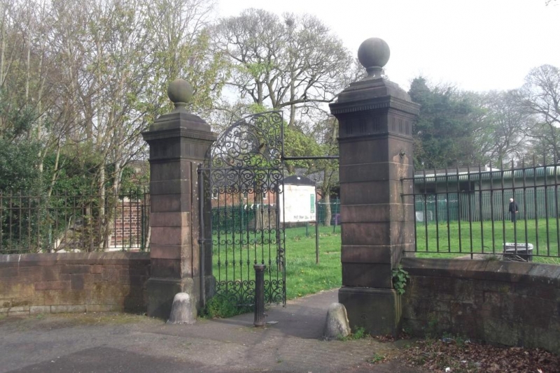
Gateway to Woolton Hall Park
(Formerly listed as WOOLTON HIGH STREET (south side), L25 Gateway to Woolton Hall Park)
14.3.75.
G.V.
II
Gatepiers and gate. C18. Two square banded stone piers with frieze of triglyphs, dentilled cornice and ball finials. Two iron gates with delicate scrolled ornament.
Listing NGR: SJ4241086643
External links are from the relevant listing authority and, where applicable, Wikidata. Wikidata IDs may be related buildings as well as this specific building. If you want to add or update a link, you will need to do so by editing the Wikidata entry.


Other nearby listed buildings