Approximate Location Map
Large Map »
Latitude: 52.1981 / 52°11'53"N
Longitude: -2.227 / 2°13'37"W
OS Eastings: 384582
OS Northings: 255562
OS Grid: SO845555
Mapcode National: GBR 1G4.1T1
Mapcode Global: VH92T.C01S
Plus Code: 9C4V5QXF+66
Entry Name: 16 and 17, Britannia Square
Listing Date: 22 May 1954
Grade: II
Source: Historic England
Source ID: 1063932
English Heritage Legacy ID: 488563
ID on this website: 101063932
Location: Britannia Square, Worcester, Worcestershire, WR1
County: Worcestershire
District: Worcester
Electoral Ward/Division: Cathedral
Parish: Non Civil Parish
Built-Up Area: Worcester
Traditional County: Worcestershire
Lieutenancy Area (Ceremonial County): Worcestershire
Church of England Parish: Worcester St George with St Mary Magdalene
Church of England Diocese: Worcester
Tagged with: Building
WORCESTER
SO8455NE BRITANNIA SQUARE
620-1/8/80 (South side)
22/5/54 Nos.16 AND 17
GV II
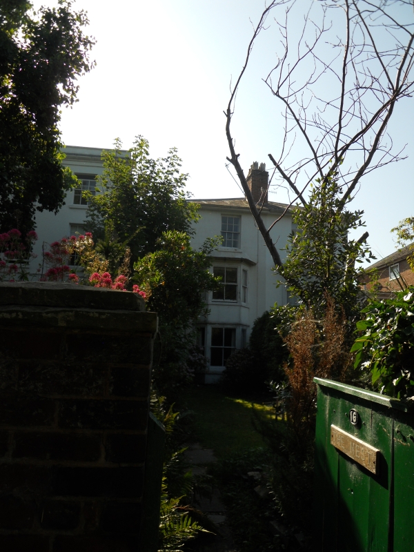
2 semi-detached houses. c1820 with later additions and
alterations. Painted stucco over brick; hipped slate roof, party
wall stack to front and rear roof slope with oversailing courses
and pots. Canted bays in timber with dentilated and bracketed
eaves. Timber-framed conservatory to left return. Double-depth
plan with entrances in 2-storey wings set back to left and right
return elevations. 3 storeys. 2 first-floor windows. Stucco
detailing includes sills. 2-storey flat-roof canted bays
(1/1:2/2:1/1) are mid c19; Second-floor windows are 6/6. 3/3
sashes to first-floor of wings. Door to left-hand house is
3-panel, upper panel glazed, bottom pair flush-beaded; French
window in return wall; both accessed through lean-to
conservatory; right-hand house has similar 3-panel door but upper
panel is raised and fielded; plain semi-elliptical fanlights.
Return elevations and wings are unpainted brick.
INTERIOR: right-hand house retains some original features
including panelled doors, architraves, picture rails; staircase
with winders and square balusters; fireplaces on second-floor.
Left house not inspected.
HISTORICAL NOTE: A glazed structure is indicated on the left-hand
house on the 1886 Ordnance Survey map drawn to a scale of 1:500.
All the listed buildings in Britannia Square (qv) form a unified
group, started in 1820 and planned around a large green in which
the main house is placed ('Springfield', qv). Compares with
similar although smaller developments in a Worcester such as
Lansdowne Crescent, Lark Hill, and Rainbow Hill Terrace (qqv).
(Buildings of England: Pevsner N: Worcestershire: Harmondsworth:
1968-1985: 334).
External links are from the relevant listing authority and, where applicable, Wikidata. Wikidata IDs may be related buildings as well as this specific building. If you want to add or update a link, you will need to do so by editing the Wikidata entry.


Other nearby listed buildings
