Approximate Location Map
Large Map »
Latitude: 51.5156 / 51°30'56"N
Longitude: -0.0899 / 0°5'23"W
OS Eastings: 532637
OS Northings: 181361
OS Grid: TQ326813
Mapcode National: GBR RB.ZW
Mapcode Global: VHGR0.D5CG
Plus Code: 9C3XGW86+63
Entry Name: 54 and 55, Coleman Street EC2
Listing Date: 5 June 1972
Grade: II
Source: Historic England
Source ID: 1064706
English Heritage Legacy ID: 199384
ID on this website: 101064706
Location: City of London, London, EC2R
County: London
District: City and County of the City of London
Electoral Ward/Division: Coleman Street
Parish: Non Civil Parish
Built-Up Area: City of London
Traditional County: Middlesex
Lieutenancy Area (Ceremonial County): City of London
Church of England Parish: St Margaret Lothbury
Church of England Diocese: London
Tagged with: Building
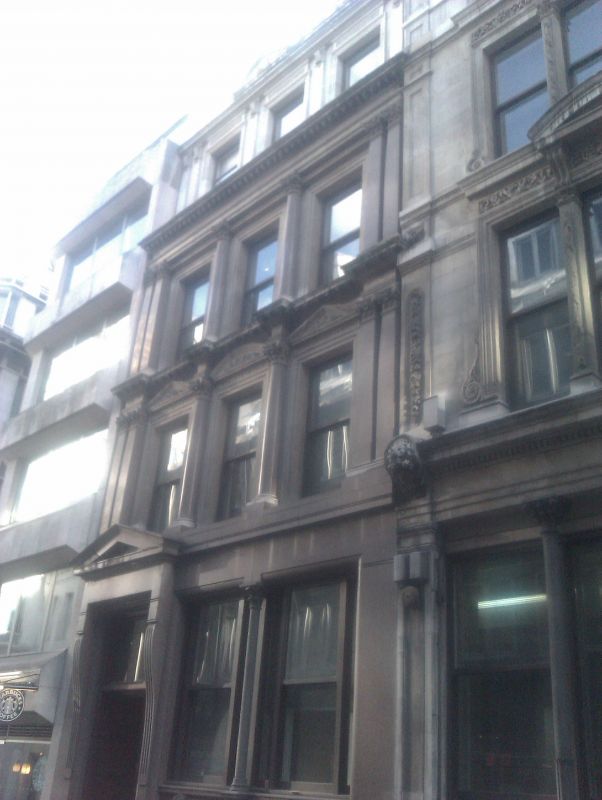
COLEMAN STREET EC2
1.
5002
(East Side)
Nos 54 and 55
TQ 3281 SE 10/273 5.6.72.
II GV
2.
Similar to Nos 51 and 52 but with decorative cast iron column on pedestal to ground floor window and slightly different doorway.
Listing NGR: TQ3263981361
External links are from the relevant listing authority and, where applicable, Wikidata. Wikidata IDs may be related buildings as well as this specific building. If you want to add or update a link, you will need to do so by editing the Wikidata entry.


Other nearby listed buildings
