Approximate Location Map
Large Map »
Latitude: 51.5142 / 51°30'51"N
Longitude: -0.1114 / 0°6'41"W
OS Eastings: 531146
OS Northings: 181169
OS Grid: TQ311811
Mapcode National: GBR MC.4C
Mapcode Global: VHGR0.06YJ
Plus Code: 9C3XGV7Q+MC
Entry Name: 123 and 124, Chancery Lane WC2
Listing Date: 5 June 1972
Grade: II
Source: Historic England
Source ID: 1064730
English Heritage Legacy ID: 199366
ID on this website: 101064730
Location: Holborn, Westminster, London, WC2A
County: London
District: City of Westminster
Electoral Ward/Division: St James's
Parish: Non Civil Parish
Built-Up Area: City of Westminster
Traditional County: Middlesex
Lieutenancy Area (Ceremonial County): Greater London
Church of England Parish: St Bride Fleet Street
Church of England Diocese: London
Tagged with: Building
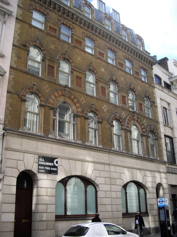
CHANCERY LANE WC2
1.
5002
(West Side)
Nos 123 and 124
TQ 3181 SW 7/69 5.6.72.
II GV
2.
Mid C19. Red and yellow brick with stone dressings and arched windows. 5 storeys. 6 windows. Cornice below top storey. Modern ground storey.
Listing NGR: TQ3114881170
External links are from the relevant listing authority and, where applicable, Wikidata. Wikidata IDs may be related buildings as well as this specific building. If you want to add or update a link, you will need to do so by editing the Wikidata entry.


Other nearby listed buildings
