Latitude: 54.9738 / 54°58'25"N
Longitude: -2.0967 / 2°5'48"W
OS Eastings: 393907
OS Northings: 564362
OS Grid: NY939643
Mapcode National: GBR FBSX.VT
Mapcode Global: WHB2C.R7RT
Plus Code: 9C6VXWF3+G8
Entry Name: Abutments and Retaining Walls to Road Bridge over Line to West and South of Hexham Railway Station
Listing Date: 22 February 1988
Grade: II
Source: Historic England
Source ID: 1064785
English Heritage Legacy ID: 239248
ID on this website: 101064785
Location: Hexham, Northumberland, NE46
County: Northumberland
Civil Parish: Hexham
Built-Up Area: Hexham
Traditional County: Northumberland
Lieutenancy Area (Ceremonial County): Northumberland
Church of England Parish: Hexham
Church of England Diocese: Newcastle
Tagged with: Building Road bridge
STATION ROAD and A6079 1. 5344 Abutments and retain- ing walls to road NY 96 SW 3/400 bridge over line to west and south of Hexham Railway Station II GV
2.
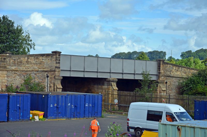
Bridge abutments to roadbridge over the Newcastle-Carlisle railway line, and retaining walls supporting the 3 raised roads leading to the bridge. 1847, at the behest of the local Turnpike Trust. Coursed sandstone rubble with rockfaced piers at intervals; these run up over a rockfaced-and-margined band at roadbed level and continue as dressed-stone buttresses to end in flattened-pyramidal tops just above the level of the slightly-chamfered parapet coping. The bridge abutments have projecting offset dressed-stone buttresses. Bridge replaced in modern riveted steel. An arched opening through the south-western arm gives access to open land at west; and a cart ramp leads from northern arm into fields to north-west.
Listing NGR: NY9390764362
External links are from the relevant listing authority and, where applicable, Wikidata. Wikidata IDs may be related buildings as well as this specific building. If you want to add or update a link, you will need to do so by editing the Wikidata entry.


Other nearby listed buildings