Latitude: 51.3669 / 51°22'0"N
Longitude: -0.1661 / 0°9'57"W
OS Eastings: 527763
OS Northings: 164693
OS Grid: TQ277646
Mapcode National: GBR DD.QSL
Mapcode Global: VHGRK.2WKZ
Plus Code: 9C3X9R8M+QH
Entry Name: 25, West Street Lane
Listing Date: 1 March 1974
Grade: II
Source: Historic England
Source ID: 1065641
English Heritage Legacy ID: 206821
ID on this website: 101065641
Location: Carshalton, Sutton, London, SM5
County: London
District: Sutton
Electoral Ward/Division: Carshalton Central
Parish: Non Civil Parish
Built-Up Area: Sutton
Traditional County: Surrey
Lieutenancy Area (Ceremonial County): Greater London
Church of England Parish: Carshalton All Saints
Church of England Diocese: Southwark
Tagged with: Building
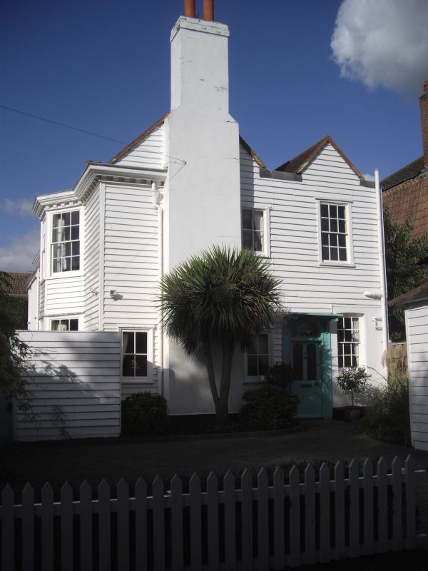
WEST STREET LANE 1. 4430 (North Side) CARSHALTON No 25 TQ 2764 NE 18/211 II 2. C18, later C18 extension. 2-storey house at right angles to road. Weather- boarded with tiled "M" roof, the front slope now slated. Garden front to west of 3 window bays; at right hand end a splayed bay window through both storeys. Eaves cornice. Central doorway with fanlight and pediment on brackets. Addition of 2 storeys, 1 window bay to north; this and rear front are rendered. 2nd doorway with fanlight and hood on south side. See article by K Gravett in Surrey Archaeological Society Annual Report, 1966. Family home of Whitakers, one of whom buried in Carshalton Churchyard 1735.
Listing NGR: TQ2776364693
External links are from the relevant listing authority and, where applicable, Wikidata. Wikidata IDs may be related buildings as well as this specific building. If you want to add or update a link, you will need to do so by editing the Wikidata entry.


Other nearby listed buildings