Approximate Location Map
Large Map »
Latitude: 51.2826 / 51°16'57"N
Longitude: 1.082 / 1°4'55"E
OS Eastings: 615023
OS Northings: 158234
OS Grid: TR150582
Mapcode National: GBR TY2.JCQ
Mapcode Global: VHLGM.P1V1
Plus Code: 9F3373MJ+3Q
Entry Name: 15, St Radigund Street
Listing Date: 7 September 1973
Grade: II
Source: Historic England
Source ID: 1065776
English Heritage Legacy ID: 443273
ID on this website: 101065776
Location: Northgate, Canterbury, Kent, CT1
County: Kent
District: Canterbury
Electoral Ward/Division: Westgate
Parish: Non Civil Parish
Built-Up Area: Canterbury
Traditional County: Kent
Lieutenancy Area (Ceremonial County): Kent
Tagged with: Building
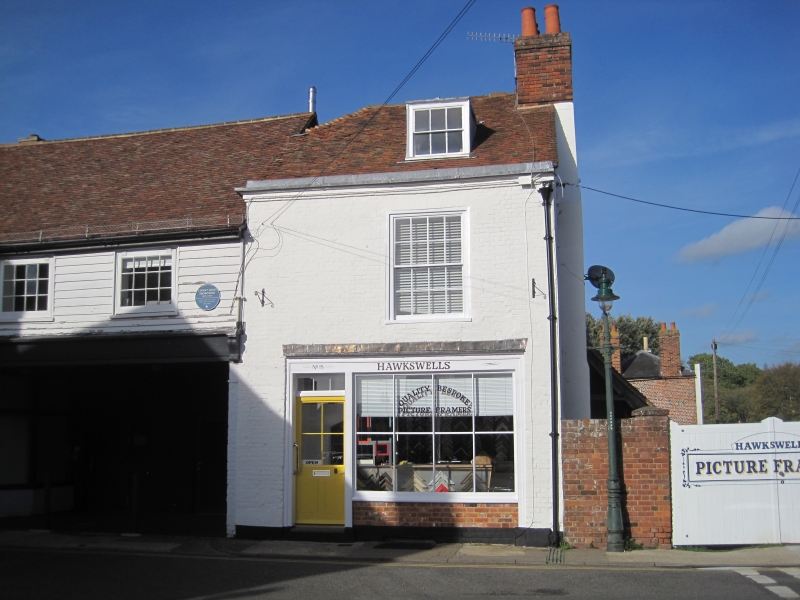
1.
944 ST RADIGUND STREET
(North Side)
No 15
TR 1558 SW 3/698
II GV
2.
Late C18. 2 storeys painted brick. Old tiled roof with 1 dormer. Moulded
eaves cornice. 1 sash with verticals only. Early C19 shop front.
Nos 5 to 13 (consec) and Nos 15 and 16 form a group.
Listing NGR: TR1502358234
External links are from the relevant listing authority and, where applicable, Wikidata. Wikidata IDs may be related buildings as well as this specific building. If you want to add or update a link, you will need to do so by editing the Wikidata entry.


Other nearby listed buildings
