Approximate Location Map
Large Map »
Latitude: 52.2835 / 52°17'0"N
Longitude: -1.0017 / 1°0'6"W
OS Eastings: 468194
OS Northings: 265505
OS Grid: SP681655
Mapcode National: GBR 9T6.ZGD
Mapcode Global: VHDRQ.LV8W
Plus Code: 9C4W7XMX+98
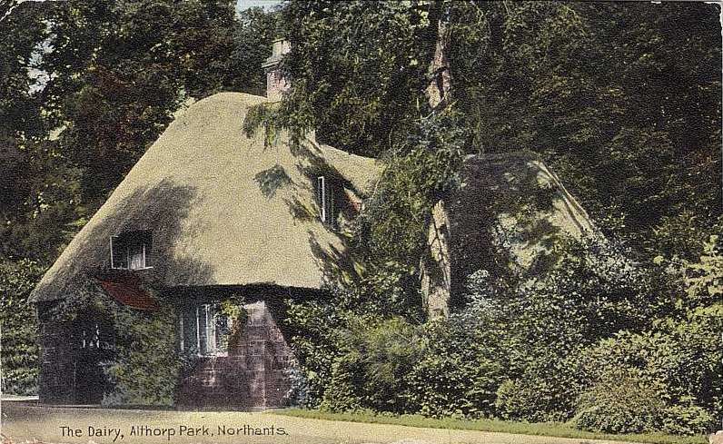
Entry Name: Dairy Cottage
Listing Date: 17 December 1986
Grade: II
Source: Historic England
Source ID: 1067641
English Heritage Legacy ID: 359991
ID on this website: 101067641
Location: West Northamptonshire, NN7
County: West Northamptonshire
Civil Parish: Althorp
Traditional County: Northamptonshire
Lieutenancy Area (Ceremonial County): Northamptonshire
Tagged with: Cottage
SP66NW ALTHORP
7/2 Althorp, Dairy Cottage
II
Dairy, now house. Late C18. Probably by H. Holland. Ashlar lias with C20 slate
roof. 2 unit plan. 2 storeys with attic. Central C19 door with porch flanked
by casements under flat arch heads. Hipped roof has central dormer. Central
stone stack.
Listing NGR: SP6818865067
External links are from the relevant listing authority and, where applicable, Wikidata. Wikidata IDs may be related buildings as well as this specific building. If you want to add or update a link, you will need to do so by editing the Wikidata entry.


Other nearby listed buildings
