Latitude: 52.2579 / 52°15'28"N
Longitude: -1.1644 / 1°9'51"W
OS Eastings: 457133
OS Northings: 262516
OS Grid: SP571625
Mapcode National: GBR 8S2.DFB
Mapcode Global: VHCVC.RHSZ
Plus Code: 9C4W7R5P+46
Entry Name: The Dun Cow Inn
Listing Date: 19 September 1977
Grade: II
Source: Historic England
Source ID: 1067691
English Heritage Legacy ID: 359919
Also known as: Dun Cow
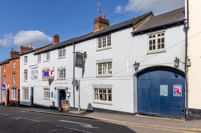
The Dun Cow, Daventry
ID on this website: 101067691
Location: Daventry, West Northamptonshire, NN11
County: West Northamptonshire
Civil Parish: Daventry
Built-Up Area: Daventry
Traditional County: Northamptonshire
Lieutenancy Area (Ceremonial County): Northamptonshire
Church of England Parish: Daventry Holy Cross
Church of England Diocese: Peterborough
BROOK STREET 1. 5524 (East Side) No 4 (The Dun Cow Inn) SP 5762 1/10 II GV 2. Late C18 front. Stucco, Welsh slated roof with brick cornice. 3 storeys, 3 casement windows with glazing bars. Segmental carriage archway to yard.
Listing NGR: SP5713462526
External links are from the relevant listing authority and, where applicable, Wikidata. Wikidata IDs may be related buildings as well as this specific building. If you want to add or update a link, you will need to do so by editing the Wikidata entry.


Other nearby listed buildings