Latitude: 51.7941 / 51°47'38"N
Longitude: -0.6593 / 0°39'33"W
OS Eastings: 492556
OS Northings: 211453
OS Grid: SP925114
Mapcode National: GBR F4N.G3S
Mapcode Global: VHFRW.J59H
Plus Code: 9C3XQ8VR+J7
Entry Name: Wall to Tring Park to East of Number 8
Listing Date: 29 May 1986
Grade: II
Source: Historic England
Source ID: 1067823
English Heritage Legacy ID: 355705
ID on this website: 101067823
Location: Tring, Dacorum, Hertfordshire, HP23
County: Hertfordshire
District: Dacorum
Civil Parish: Tring
Built-Up Area: Tring
Traditional County: Hertfordshire
Lieutenancy Area (Ceremonial County): Hertfordshire
Church of England Parish: Tring
Church of England Diocese: St.Albans
Tagged with: Wall
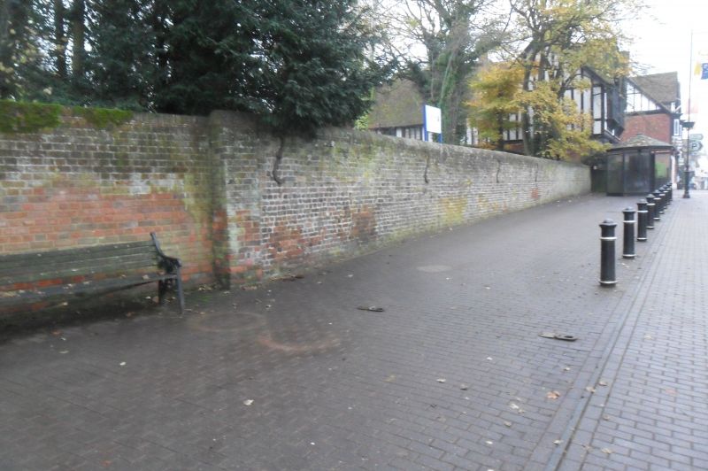
TRING HIGH STREET
SP 9211
(South side)
11/69 Wall to Tring Park
- to E of No. 8
GV II
Boundary wall. Early C18, probably c.1711 for John Gore. Red brick, with
some blue bricks. A 2m high wall mostly in header bond, with special
rounded brick-on-edge copings. Built when main road diverted here from
crossing park to S of house. Earth swept up to garden side conceals wall
which itself was built to conceal traffic on the road where it crosses a
grand vista to N of house in vast landscaped scheme shown in
contemporary engraving. (Richards(1974)25).
Listing NGR: SP9255611453
External links are from the relevant listing authority and, where applicable, Wikidata. Wikidata IDs may be related buildings as well as this specific building. If you want to add or update a link, you will need to do so by editing the Wikidata entry.


Other nearby listed buildings