Latitude: 53.4756 / 53°28'32"N
Longitude: -2.1488 / 2°8'55"W
OS Eastings: 390219
OS Northings: 397664
OS Grid: SJ902976
Mapcode National: GBR FXF7.LT
Mapcode Global: WHB9H.YWXX
Plus Code: 9C5VFVG2+6F
Entry Name: The Bungalow
Listing Date: 17 November 1966
Last Amended: 14 July 1987
Grade: II
Source: Historic England
Source ID: 1067978
English Heritage Legacy ID: 212724
ID on this website: 101067978
Location: Droylsden, Tameside, Greater Manchester, M43
County: Tameside
Electoral Ward/Division: Droylsden East
Parish: Non Civil Parish
Built-Up Area: Droylsden
Traditional County: Lancashire
Lieutenancy Area (Ceremonial County): Greater Manchester
Church of England Parish: Droylsden St Mary
Church of England Diocese: Manchester
Tagged with: Building
DROYLSDEN FAIRFIELD SQUARE SJ 99 NW
4/68 No. 11A (The Bungalow) (formerly listed as Nos 11, llA, 12 and 13) 17/11/66
G.V. II
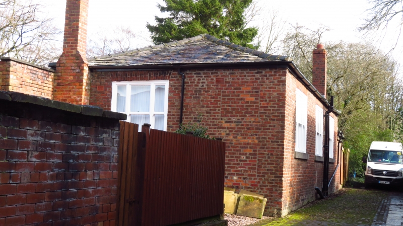
Moravian sunday school, now house. 1793. English garden wall bond brick with graduated slate roof. 3-bay single- storey house with small C20 addition to left return. 2 tripartite sash windows (without glazing bars) under flat brick arches. The second now incorporates the door. A small third window is of C19 date. Hipped roof. 3 tripartite sash windows to rear.
Listing NGR: SJ9021997663
External links are from the relevant listing authority and, where applicable, Wikidata. Wikidata IDs may be related buildings as well as this specific building. If you want to add or update a link, you will need to do so by editing the Wikidata entry.


Other nearby listed buildings