Latitude: 53.4091 / 53°24'32"N
Longitude: -2.9412 / 2°56'28"W
OS Eastings: 337531
OS Northings: 390663
OS Grid: SJ375906
Mapcode National: GBR 7FM.RX
Mapcode Global: WH877.SKMW
Plus Code: 9C5VC355+JG
Entry Name: 293, Edge Lane
Listing Date: 14 March 1975
Grade: II
Source: Historic England
Source ID: 1068263
English Heritage Legacy ID: 214054
ID on this website: 101068263
Location: Kensington, Liverpool, Merseyside, L7
County: Liverpool
Electoral Ward/Division: Kensington and Fairfield
Parish: Non Civil Parish
Built-Up Area: Liverpool
Traditional County: Lancashire
Lieutenancy Area (Ceremonial County): Merseyside
Church of England Parish: Liverpool, All Saints
Church of England Diocese: Liverpool
Tagged with: Building
SJ 3790 EDGE LANE L7
28/415 No.293
14.3.75 - II
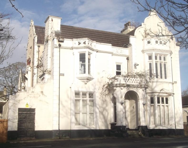
House. Dated 1846 on gable to left return. Brick with stone dressings, slate roof. 2 storeys. 3 bays, stone plinth; rusticated quoins to end bays (centre bay recessed); cornice and parapet. Ground floor has projecting 6-light cross window to left and canted 2 storey bay window to right of porch which has round-arched openings to front and returns, flat pilasters with strap work bands, consoled cornice and pierced balcony above. 1st floor has triangular oriel to 1st bay which has mullions and transom to upper level, pierced balustrade above and strapwork cresting. Shaped gable to end bay. Window frames and door mostly gone (1984). Left return has 4 gables of varying heights, one has stack with blind crosss. Right return has 2 end stacks. Left return date 1846 to able and rainwater head.
Listing NGR: SJ3753190663
External links are from the relevant listing authority and, where applicable, Wikidata. Wikidata IDs may be related buildings as well as this specific building. If you want to add or update a link, you will need to do so by editing the Wikidata entry.


Other nearby listed buildings