Approximate Location Map
Large Map »
Latitude: 51.3715 / 51°22'17"N
Longitude: 0.0732 / 0°4'23"E
OS Eastings: 544404
OS Northings: 165648
OS Grid: TQ444656
Mapcode National: GBR NS.C49
Mapcode Global: VHHP4.7S1G
Plus Code: 9F3293CF+J7
Entry Name: The Lodge
Listing Date: 29 June 1973
Grade: II
Source: Historic England
Source ID: 1068864
English Heritage Legacy ID: 358419
ID on this website: 101068864
Location: Crofton, Bromley, London, BR6
County: London
District: Bromley
Electoral Ward/Division: Farnborough and Crofton
Parish: Non Civil Parish
Built-Up Area: Bromley
Traditional County: Kent
Lieutenancy Area (Ceremonial County): Greater London
Church of England Parish: Crofton St Paul
Church of England Diocese: Rochester
Tagged with: Gatehouse
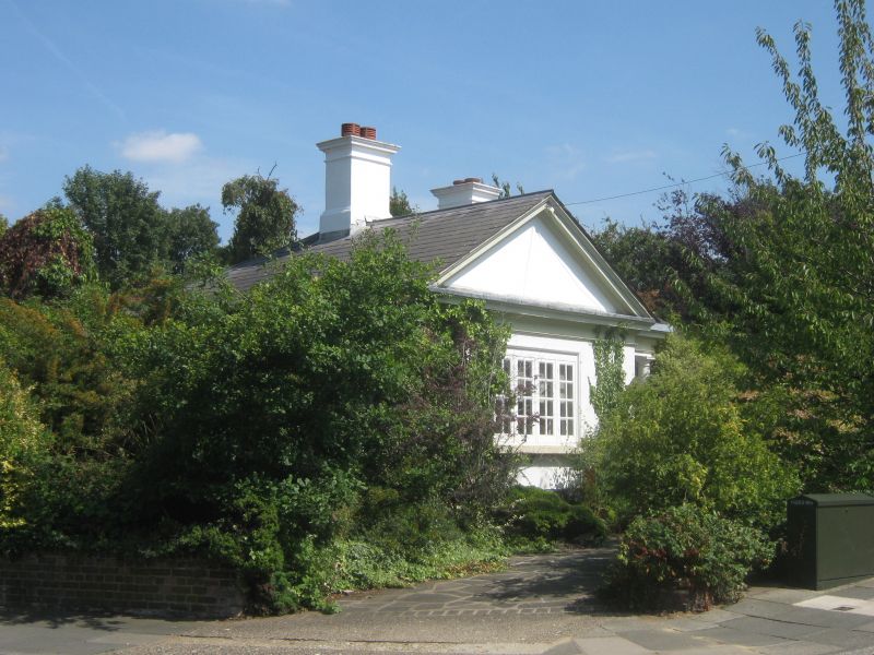
CROFTON AVENUE, ORPINGTON
1.
4407
No 35 (The Lodge)
TQ 46 NW 5/115
II
2.
Circa 1860. L-shaped. 1 storey stuccoed. Slate roof, left side has
gable in the shape of a pediment. Coved eaves cornice. 1 4-light C19
casement. Porch with Tuscan column. 4 panelled door. Plinth.
Listing NGR: TQ4440465648
External links are from the relevant listing authority and, where applicable, Wikidata. Wikidata IDs may be related buildings as well as this specific building. If you want to add or update a link, you will need to do so by editing the Wikidata entry.


Other nearby listed buildings
