Approximate Location Map
Large Map »
Latitude: 51.072 / 51°4'19"N
Longitude: 1.0784 / 1°4'42"E
OS Eastings: 615755
OS Northings: 134808
OS Grid: TR157348
Mapcode National: GBR V0L.PH1
Mapcode Global: FRA F649.3XV
Plus Code: 9F3333CH+R9
Entry Name: 46, Bartholomew Street
Listing Date: 21 December 1973
Grade: II
Source: Historic England
Source ID: 1068968
English Heritage Legacy ID: 175083
ID on this website: 101068968
Location: Hythe, Folkestone and Hythe, Kent, CT21
County: Kent
District: Folkestone and Hythe
Civil Parish: Hythe
Built-Up Area: Hythe
Traditional County: Kent
Lieutenancy Area (Ceremonial County): Kent
Tagged with: Building
1.
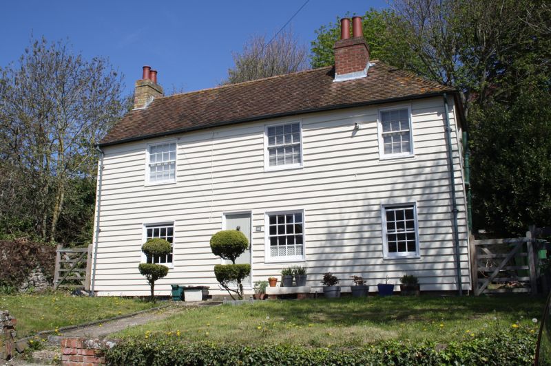
1253 BARTHOLOMEW STREET
(North Side)
No 46
TR 1534 NE 1/34
II
2.
Late C18 to early C19. 2 storeys weatherboarded. Tiled roof, hipped at one
end with 1 brick chimney. 3 sashes with glazing bars intact. Simple doorcase
with flat wooden weather hood on brackets. The right side elevation is of painted
brick and has some narrow timber framing with some diagonal braces.
Listing NGR: TR1575534808
External links are from the relevant listing authority and, where applicable, Wikidata. Wikidata IDs may be related buildings as well as this specific building. If you want to add or update a link, you will need to do so by editing the Wikidata entry.


Other nearby listed buildings
