Approximate Location Map
Large Map »
Latitude: 51.3115 / 51°18'41"N
Longitude: 0.8738 / 0°52'25"E
OS Eastings: 600380
OS Northings: 160851
OS Grid: TR003608
Mapcode National: GBR RTR.RQP
Mapcode Global: VHKJW.398G
Plus Code: 9F328V6F+HG
Entry Name: 15, Ospringe Street
Listing Date: 29 July 1950
Grade: II*
Source: Historic England
Source ID: 1069430
English Heritage Legacy ID: 175958
ID on this website: 101069430
Location: Ospringe, Swale, Kent, ME13
County: Kent
District: Swale
Civil Parish: Faversham
Built-Up Area: Faversham
Traditional County: Kent
Lieutenancy Area (Ceremonial County): Kent
Tagged with: Building
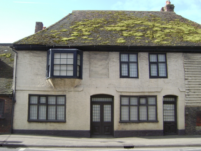
OSPRINGE STREET
1.
1103 (South Side)
---------------
No 15
TR 0060 11/170 29.7.50.
II*
GV
2.
The West end of this building is part of the medieval Maison Dieu
Hospital, founded in 1230, of which, the main buildings were on the
North side of the road. The ground floor of this section of the
building is of flints, with a corner post visible. Above it is
a timber-framed structure, of which part overhangs on the 1st
floor on the West front but part has been rebuilt in red brick
and part is hung with tiles. The East end of the building is
C17. All this section is of red brick. Eaves bracket cornice.
1 bay on the 1st floor with a cove beneath it and a sash window,
its glazing bars intact. The other windows in the whole building
are casement windows. Hipped tiled roof. 2 storeys. 4 windows.
Cl3 undercroft.
Nos 1 to l9 (odd) form a group.
Listing NGR: TR0037660848
External links are from the relevant listing authority and, where applicable, Wikidata. Wikidata IDs may be related buildings as well as this specific building. If you want to add or update a link, you will need to do so by editing the Wikidata entry.


Other nearby listed buildings
