Approximate Location Map
Large Map »
Latitude: 51.3106 / 51°18'38"N
Longitude: 0.8924 / 0°53'32"E
OS Eastings: 601681
OS Northings: 160800
OS Grid: TR016608
Mapcode National: GBR SW3.QG7
Mapcode Global: VHKJW.FB35
Plus Code: 9F328V6R+6W
Entry Name: Wall Enclosing Churchyard on West Side
Listing Date: 3 August 1972
Grade: II
Source: Historic England
Source ID: 1069437
English Heritage Legacy ID: 175974
ID on this website: 101069437
Location: Preston, Swale, Kent, ME13
County: Kent
District: Swale
Civil Parish: Faversham
Built-Up Area: Faversham
Traditional County: Kent
Lieutenancy Area (Ceremonial County): Kent
Tagged with: Wall
PRESTON LANE
1. ------------
llO3
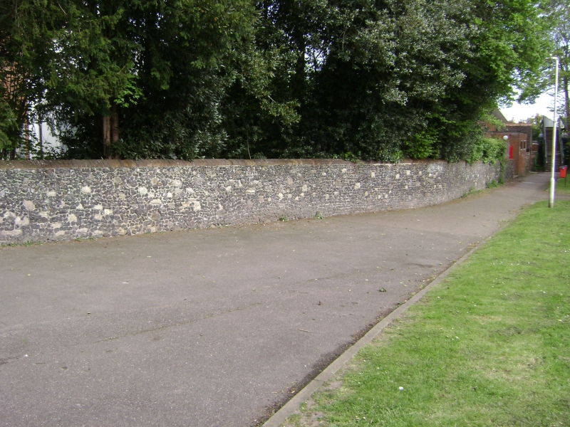
Wall enclosing Churchyard
on West Side
TR 0160 12/142A
II GV
2.
Cl9. Cleft flint with some stone nibble; brick coping. About 5 feet
high. Wall incorporated into Sunday School to the north and then extending
as far as railway.
St Catherine's Church, Preston Vicarage and Wall form a group.
Listing NGR: TR0168260800
External links are from the relevant listing authority and, where applicable, Wikidata. Wikidata IDs may be related buildings as well as this specific building. If you want to add or update a link, you will need to do so by editing the Wikidata entry.


Other nearby listed buildings
