Latitude: 51.3156 / 51°18'56"N
Longitude: 0.8908 / 0°53'26"E
OS Eastings: 601548
OS Northings: 161358
OS Grid: TR015613
Mapcode National: GBR SW3.J0C
Mapcode Global: VHKJW.D688
Plus Code: 9F328V8R+68
Entry Name: 15, the Market Place
Listing Date: 3 August 1972
Grade: II
Source: Historic England
Source ID: 1069466
English Heritage Legacy ID: 175943
ID on this website: 101069466
Location: Faversham, Swale, Kent, ME13
County: Kent
District: Swale
Civil Parish: Faversham
Built-Up Area: Faversham
Traditional County: Kent
Lieutenancy Area (Ceremonial County): Kent
Tagged with: Building
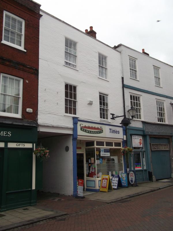
THE MARKET PLACE
1.
1103 (South Side)
---------------
No 15
TR O161 SE 3/12
II GV
2.
Early C19. 3 storeys. 2 windows. Painted brick. Parapet. Glazing
bars above 1st floor. Modern shop front. Carriage arch to the East of
the shop front.
All the listed buildings in the Market Place form a group.
Also Nos 14 to 16 (consec) form a group with Nos 1 and 2,
4 to 12 (consec) West Street.
Listing NGR: TR0154661353
External links are from the relevant listing authority and, where applicable, Wikidata. Wikidata IDs may be related buildings as well as this specific building. If you want to add or update a link, you will need to do so by editing the Wikidata entry.


Other nearby listed buildings