Latitude: 51.1263 / 51°7'34"N
Longitude: 1.316 / 1°18'57"E
OS Eastings: 632126
OS Northings: 141560
OS Grid: TR321415
Mapcode National: GBR X2Z.9K5
Mapcode Global: VHLHB.RYLH
Plus Code: 9F3348G8+GC
Entry Name: 16-32, Castle Street
Listing Date: 17 December 1973
Grade: II
Source: Historic England
Source ID: 1069527
English Heritage Legacy ID: 177735
ID on this website: 101069527
Location: Victoria Park Mews, Dover, Kent, CT16
County: Kent
District: Dover
Civil Parish: Dover
Built-Up Area: Dover
Traditional County: Kent
Lieutenancy Area (Ceremonial County): Kent
Tagged with: Building
CASTLE STREET l. (South East Side) 1050 Nos 16 to 32 (even) TR 3241 1/20
II GV
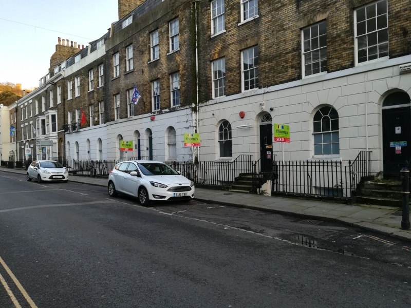
2. A mid C19 terrace. 3 storeys, basement and attics, yellow brick. Slate mansard roof with l0 dormers. 2 or 3 sashes each with most glazing bars intact. Nos 22- 30 have a stuccoed and rusticated base and No 30 has a keystone in the form of a term. Nos 18 and 20 have 2 3-light canted bays through all storeys. Stringcourse. Mostly round-headed doorcases. Spear railings and hand rails.
Nos 16 to 58 (even) form a group.
Listing NGR: TR3212641560
External links are from the relevant listing authority and, where applicable, Wikidata. Wikidata IDs may be related buildings as well as this specific building. If you want to add or update a link, you will need to do so by editing the Wikidata entry.


Other nearby listed buildings