Approximate Location Map
Large Map »
Latitude: 51.1325 / 51°7'56"N
Longitude: 1.3063 / 1°18'22"E
OS Eastings: 631413
OS Northings: 142223
OS Grid: TR314422
Mapcode National: GBR X2S.T8M
Mapcode Global: VHLHB.LSFP
Plus Code: 9F3348J4+XG
Entry Name: 52, Charlton Green
Listing Date: 17 December 1973
Grade: II
Source: Historic England
Source ID: 1069529
English Heritage Legacy ID: 177741
ID on this website: 101069529
Location: Dover, Kent, CT16
County: Kent
District: Dover
Civil Parish: Dover
Built-Up Area: Dover
Traditional County: Kent
Lieutenancy Area (Ceremonial County): Kent
Tagged with: Building
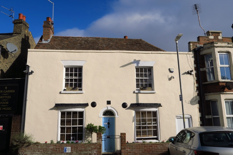
CHARLTON GREEN
1. (North East Side)
1050
No 52
TR 3141 3/46
II
2.
Early C19. 2 storeys red brick. Tiled roof with parapet and stone coping.
2 sashes with glazing bars intact and stone cills. Ground floor has 2 curved
bows. Central round-headed doorcase with keystone and shell fanlight. The
original door has been replaced.
Listing NGR: TR3141342223
External links are from the relevant listing authority and, where applicable, Wikidata. Wikidata IDs may be related buildings as well as this specific building. If you want to add or update a link, you will need to do so by editing the Wikidata entry.


Other nearby listed buildings
