Latitude: 51.2765 / 51°16'35"N
Longitude: 1.3375 / 1°20'15"E
OS Eastings: 632871
OS Northings: 158335
OS Grid: TR328583
Mapcode National: GBR X12.WGX
Mapcode Global: VHLGS.45FR
Plus Code: 9F3378GQ+J2
Entry Name: Former Site of Nos 8 and 10 and Boundary Walling
Listing Date: 23 April 1976
Grade: II
Source: Historic England
Source ID: 1069700
English Heritage Legacy ID: 177346
ID on this website: 101069700
Location: Sandwich, Dover, Kent, CT13
County: Kent
District: Dover
Civil Parish: Sandwich
Built-Up Area: Sandwich
Traditional County: Kent
Lieutenancy Area (Ceremonial County): Kent
Tagged with: Building
1. 5275 CHURCH STREET ST MARY'S (East Side) Former site of Nos 8 and 10 and Boundary Walling TR 3258 1/244
II
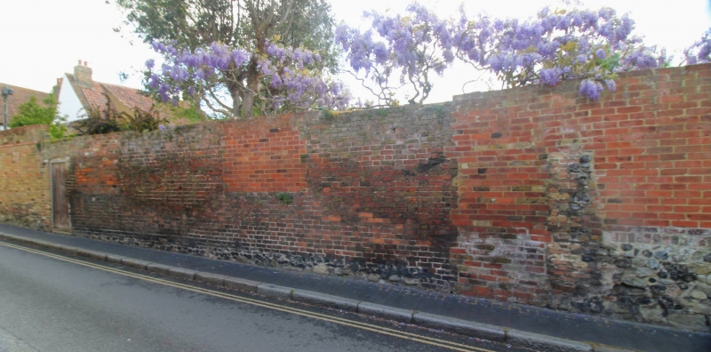
2. Front boundary walling of this site is of mediaeval stone and flint and the upper part of brick of varying periods and colours with the remains of doors and windows of Nos 8 and 10 still in position. The rest of the buildings behind this front wall have been demolished. 7 ft high by 63 ft.
Listing NGR: TR3287158334
External links are from the relevant listing authority and, where applicable, Wikidata. Wikidata IDs may be related buildings as well as this specific building. If you want to add or update a link, you will need to do so by editing the Wikidata entry.


Other nearby listed buildings