Approximate Location Map
Large Map »
Latitude: 51.2278 / 51°13'40"N
Longitude: 1.404 / 1°24'14"E
OS Eastings: 637756
OS Northings: 153133
OS Grid: TR377531
Mapcode National: GBR X1R.V3L
Mapcode Global: VHMDG.9D2L
Plus Code: 9F336CH3+4H
Entry Name: 12, Silver Street
Listing Date: 8 February 1974
Grade: II
Source: Historic England
Source ID: 1069745
English Heritage Legacy ID: 177256
ID on this website: 101069745
Location: Deal, Dover, Kent, CT14
County: Kent
District: Dover
Civil Parish: Deal
Built-Up Area: Deal
Traditional County: Kent
Lieutenancy Area (Ceremonial County): Kent
Tagged with: Building
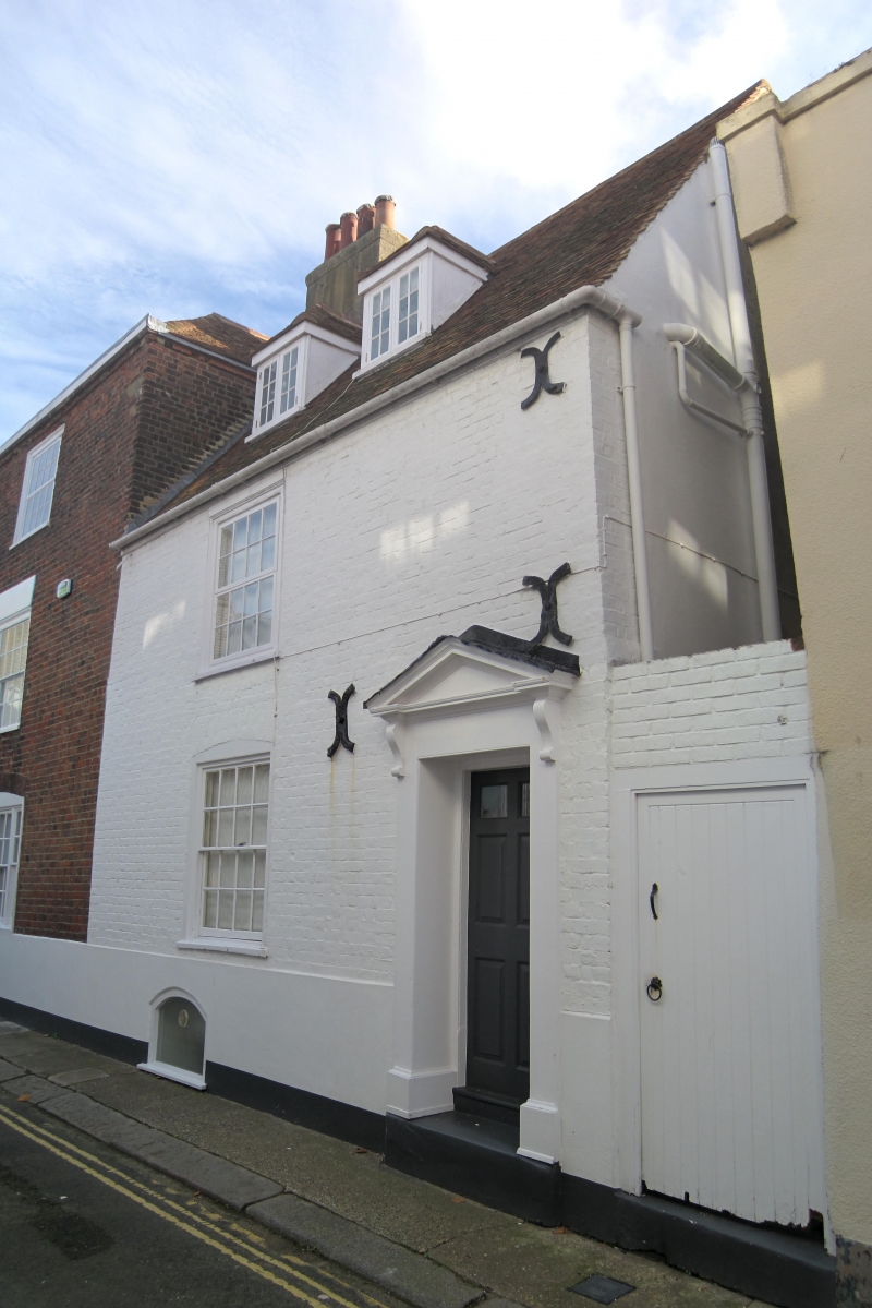
SILVER STREET
1.
1035
(South Side)
No 12
TR 3753 SE 2/100
II GV
2.
Mid C18. 2 storeys and attics painted brick. Old tiled roof with 1 modern dormer.
1 sash with glazing bars intact. Right side open pedimented doorcase with console
brackets.
Nos 11 to 15 (consec) form a group.
Listing NGR: TR3775653133
External links are from the relevant listing authority and, where applicable, Wikidata. Wikidata IDs may be related buildings as well as this specific building. If you want to add or update a link, you will need to do so by editing the Wikidata entry.


Other nearby listed buildings
