Approximate Location Map
Large Map »
Latitude: 51.2264 / 51°13'34"N
Longitude: 1.4017 / 1°24'6"E
OS Eastings: 637606
OS Northings: 152962
OS Grid: TR376529
Mapcode National: GBR X1Y.16V
Mapcode Global: VHMDG.7FWQ
Plus Code: 9F336CG2+GM
Entry Name: 19-31, Union Road
Listing Date: 8 February 1974
Grade: II
Source: Historic England
Source ID: 1069749
English Heritage Legacy ID: 177265
ID on this website: 101069749
Location: Deal, Dover, Kent, CT14
County: Kent
District: Dover
Civil Parish: Deal
Built-Up Area: Deal
Traditional County: Kent
Lieutenancy Area (Ceremonial County): Kent
Tagged with: Building
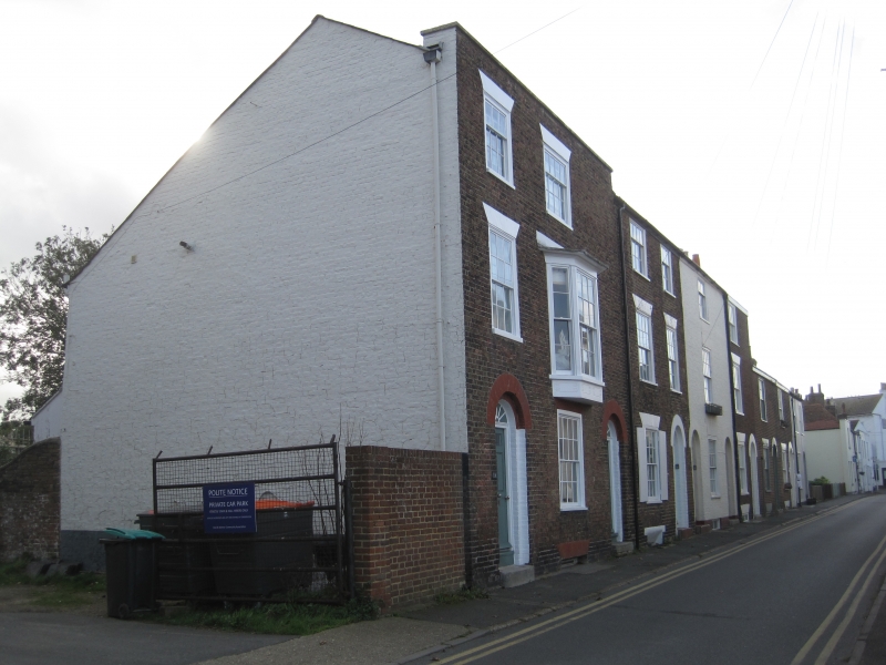
UNION ROAD
1.
1035 (South East Side)
Nos 19 to 31 (odd)
TR 3753 NE 1/415
II GV
An early C19 terrace - not uniform. Nos 27-31 are of 2 storeys, the rest 3 storeys
and basement, brown brick. No 31 is stuccoed, No 23 is painted. Parapets.
1 or 2 sashes with most glazing bars intact. No 19 has a 1st floor 3 light canted
bay. Simple round-headed doorcases with it panelled doors, some having fielded
panels. No 21 has shell moulding in its fanlight.
Nos 19-31 (odd) form a group.
Listing NGR: TR3760652962
External links are from the relevant listing authority and, where applicable, Wikidata. Wikidata IDs may be related buildings as well as this specific building. If you want to add or update a link, you will need to do so by editing the Wikidata entry.


Other nearby listed buildings
