Approximate Location Map
Large Map »
Latitude: 51.2281 / 51°13'41"N
Longitude: 1.4036 / 1°24'12"E
OS Eastings: 637729
OS Northings: 153167
OS Grid: TR377531
Mapcode National: GBR X1R.TZL
Mapcode Global: VHMDG.8DWC
Plus Code: 9F336CH3+7C
Entry Name: 17, Griffin Street
Listing Date: 1 June 1949
Grade: II
Source: Historic England
Source ID: 1069851
English Heritage Legacy ID: 177101
ID on this website: 101069851
Location: Deal, Dover, Kent, CT14
County: Kent
District: Dover
Civil Parish: Deal
Built-Up Area: Deal
Traditional County: Kent
Lieutenancy Area (Ceremonial County): Kent
Tagged with: Building
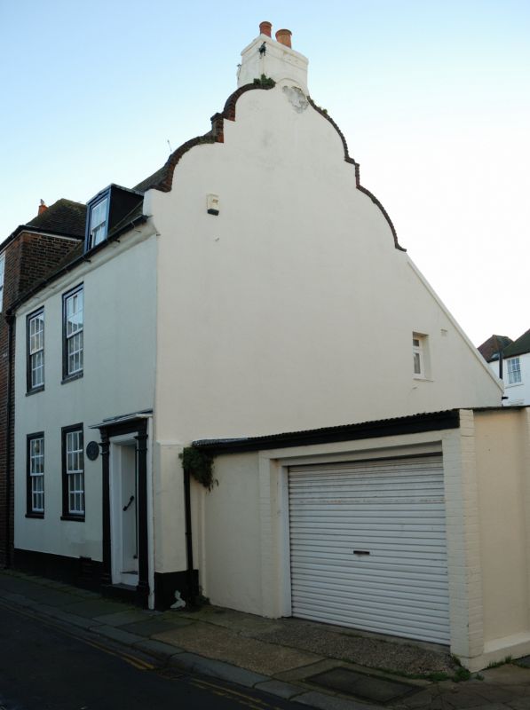
GRIFFIN STREET
1.
1035
(South Side)
No 17
TR 3753 SE 2/95 1.6.49. 17
II GV
2.
Late C17 to early C18. 2 storeys basement and attics stuccoed. Roof has 1 dormer
and Dutch shaped gable end. 2 sashes with thick glazing bars. Plinth. Right
side doorcase with reeded pilasters, entablature and flat hood. 2 panelled door
and 2 steps to street.
Nos 13 to 17 (consec) form a group.
Listing NGR: TR3772953167
External links are from the relevant listing authority and, where applicable, Wikidata. Wikidata IDs may be related buildings as well as this specific building. If you want to add or update a link, you will need to do so by editing the Wikidata entry.


Other nearby listed buildings
