Approximate Location Map
Large Map »
Latitude: 51.2261 / 51°13'33"N
Longitude: 1.404 / 1°24'14"E
OS Eastings: 637764
OS Northings: 152936
OS Grid: TR377529
Mapcode National: GBR X1Y.1SH
Mapcode Global: VHMDG.9F2Y
Plus Code: 9F336CG3+CH
Entry Name: 109, Beach Street
Listing Date: 8 February 1974
Grade: II
Source: Historic England
Source ID: 1069918
English Heritage Legacy ID: 176964
ID on this website: 101069918
Location: Deal, Dover, Kent, CT14
County: Kent
District: Dover
Civil Parish: Deal
Built-Up Area: Deal
Traditional County: Kent
Lieutenancy Area (Ceremonial County): Kent
Tagged with: Building
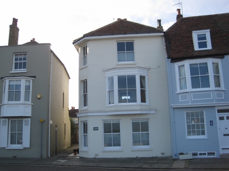
BEACH STREET
1.
1035
(West Side)
No 109
Tn 3752 NE 1/196
II GV
2.
Late C18 to early C19, 3 storeys stuccoed. Hipped tiled roof. 2 sashes with
verticals only and 3 light canted bay on 1st floor. 3 sashes to ground floor.
Doorcase in side elevation.
No 101 and Nos 105 to 117 (odd) form a group.
Listing NGR: TR3776452936
External links are from the relevant listing authority and, where applicable, Wikidata. Wikidata IDs may be related buildings as well as this specific building. If you want to add or update a link, you will need to do so by editing the Wikidata entry.


Other nearby listed buildings
