Latitude: 51.2636 / 51°15'49"N
Longitude: 1.2515 / 1°15'5"E
OS Eastings: 626934
OS Northings: 156632
OS Grid: TR269566
Mapcode National: GBR VZT.R7B
Mapcode Global: VHLGQ.MHYN
Plus Code: 9F337772+FH
Entry Name: Group of 5 Headstones 1 to 5 Metres North of South Porch of Church of St James
Listing Date: 26 November 1987
Grade: II
Source: Historic England
Source ID: 1070138
English Heritage Legacy ID: 178270
ID on this website: 101070138
Location: St James's Church, Staple, Dover, Kent, CT3
County: Kent
District: Dover
Civil Parish: Staple
Traditional County: Kent
Lieutenancy Area (Ceremonial County): Kent
Tagged with: Tombstone
TR 25 NE STAPLE THE STREET
(North Side) 5/238 Group of 5 headstones 1 to 5 metres north of south porch of Church of St. James
GV II
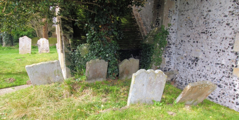
Croup of headstones to Dale family. Edward Dale, Yeoman, d.1753. About 4 feet high with winged cherub head with trumpet, crossed bones and ancanthus wreathed moulded head. John Dale, early C18, incription damaged. Crude deaths head on bat-like wings with crossed-bone background. John Dale, mid C18, about feet high with triple head and 2 skulls and crossed bones. Judith Dale, d.1738, about 3 feet high, with crude double skulls and crossed bones. John Dale, d.1728, about 2 feet high with double head and 2 skulls, so distorted as to appear to have ears, and crossed bones.
Listing NGR: TR2673656692
External links are from the relevant listing authority and, where applicable, Wikidata. Wikidata IDs may be related buildings as well as this specific building. If you want to add or update a link, you will need to do so by editing the Wikidata entry.


Other nearby listed buildings