Latitude: 51.2787 / 51°16'43"N
Longitude: 1.279 / 1°16'44"E
OS Eastings: 628781
OS Northings: 158393
OS Grid: TR287583
Mapcode National: GBR VZP.L6J
Mapcode Global: VHLGR.4402
Plus Code: 9F3377HH+FJ
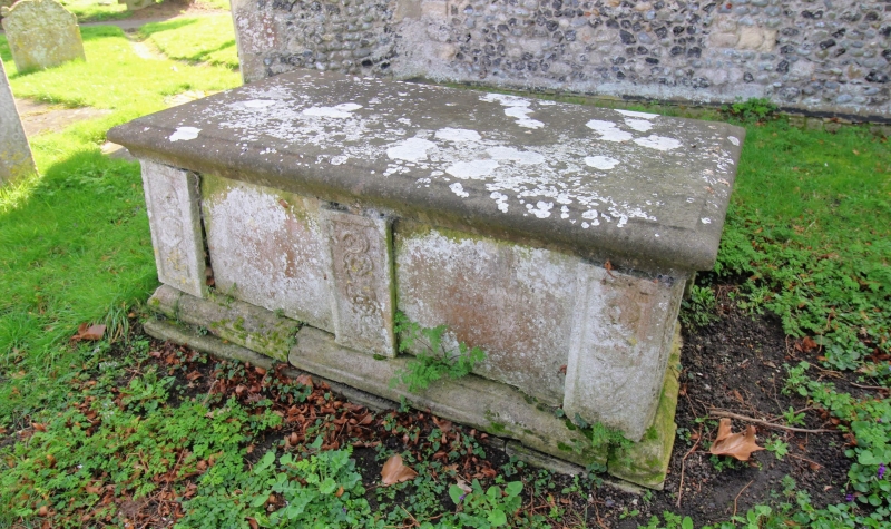
Entry Name: Chest Tomb About 2 Metres North East of Church of St Nicholas
Listing Date: 26 November 1987
Grade: II
Source: Historic England
Source ID: 1070197
English Heritage Legacy ID: 178113
ID on this website: 101070197
Location: St Nicholas's Church, Ash, Dover, Kent, CT3
County: Kent
District: Dover
Civil Parish: Ash
Built-Up Area: Ash
Traditional County: Kent
Lieutenancy Area (Ceremonial County): Kent
Tagged with: Chest tomb
ASH TR 2858 THE STREET (south side) 10/83 Chest tomb about 2 metres north east of Church of St Nicholas GV II
Chest tomb. Elizabeth-, d.1697 (?). Stone. Moulded slab. Inscription of plain side panels. Corner piers and central pier on long side decorated with death's heads, crossed bones and funerary tools, and rose scrolls.
Listing NGR: TR2877058396
External links are from the relevant listing authority and, where applicable, Wikidata. Wikidata IDs may be related buildings as well as this specific building. If you want to add or update a link, you will need to do so by editing the Wikidata entry.


Other nearby listed buildings