Latitude: 51.2783 / 51°16'41"N
Longitude: 1.2835 / 1°17'0"E
OS Eastings: 629094
OS Northings: 158362
OS Grid: TR290583
Mapcode National: GBR VZP.TJW
Mapcode Global: VHLGR.64CC
Plus Code: 9F3377HM+89
Entry Name: Streetend House and Garden Walls
Listing Date: 11 October 1963
Grade: II
Source: Historic England
Source ID: 1070224
English Heritage Legacy ID: 178076
ID on this website: 101070224
Location: Ash, Dover, Kent, CT3
County: Kent
District: Dover
Civil Parish: Ash
Built-Up Area: Ash
Traditional County: Kent
Lieutenancy Area (Ceremonial County): Kent
Tagged with: Building
ASH SANDWICH ROAD TR 2958 (south side) 11/46 Streetend House 11.10.63 and garden walls GV II
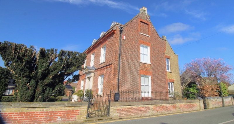
House. Early C18 altered and extended early C19. Red brick laid in Header Bond with contrasting red brick details with plain tiled roof. Two parallel ranges. Two storeys and attic on plinth with moulded plat band and projecting moulded brick cornice with parapet to roof with kneelered gables, 3 dormers, the centre one with segmental pediment, the outer 2 pedimented, and stacks to rear left and rear right. Inappropriate terracotta ridge tiles. Regular fenestration of 3 sashes on first floor, 2 on ground floor all with gauged heads. Central door of 6 raised and fielded panels with 2 light rectangular fanlight at head of 2 moulded steps. Large pedimented surround on attached Doric columns. Single storey elliptical bay on left return. C19 rear range in imitation of earlier range. Garden wall, contemporary with C19 additions, about 2 feet high surrounding garden to front and sides of main range, with 2 tier cast iron gates on north and south of the walled areas with ramped rails and twisted uprights (see B.0.E. Kent II, 1983, 130.)
Listing NGR: TR2909358362
External links are from the relevant listing authority and, where applicable, Wikidata. Wikidata IDs may be related buildings as well as this specific building. If you want to add or update a link, you will need to do so by editing the Wikidata entry.


Other nearby listed buildings