Latitude: 51.245 / 51°14'42"N
Longitude: 1.2598 / 1°15'35"E
OS Eastings: 627609
OS Northings: 154587
OS Grid: TR276545
Mapcode National: GBR W01.TKC
Mapcode Global: VHLGQ.SYCY
Plus Code: 9F3367W5+2W
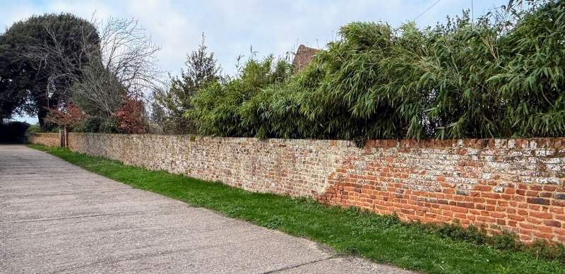
Entry Name: Wall About 30 Metres South of Rowling Court
Listing Date: 3 December 1986
Grade: II
Source: Historic England
Source ID: 1070293
English Heritage Legacy ID: 177939
ID on this website: 101070293
Location: Dover, Kent, CT3
County: Kent
District: Dover
Town: Dover
Civil Parish: Goodnestone
Traditional County: Kent
Lieutenancy Area (Ceremonial County): Kent
Tagged with: Wall
GOODNESTONE ROWLING TR 25 SE 3/78 Wall about 30 metres south of Rowling Court GV II Wall. C17. Red brick in English and Header bonds. Extends about 20 metres south from west end of Rowling Court, then extends about 50 metres east to road. Varying in height around 4 feet, and includes 2 gate piers opposite main entrance to house.
Listing NGR: TR2813653331
External links are from the relevant listing authority and, where applicable, Wikidata. Wikidata IDs may be related buildings as well as this specific building. If you want to add or update a link, you will need to do so by editing the Wikidata entry.


Other nearby listed buildings