Approximate Location Map
Large Map »
Latitude: 51.0706 / 51°4'14"N
Longitude: 0.6902 / 0°41'24"E
OS Eastings: 588571
OS Northings: 133583
OS Grid: TQ885335
Mapcode National: GBR QW3.TJY
Mapcode Global: FRA D6B9.2QW
Plus Code: 9F323MCR+63
Entry Name: 5, Ashford Road
Listing Date: 8 May 1950
Grade: II
Source: Historic England
Source ID: 1070390
English Heritage Legacy ID: 179671
ID on this website: 101070390
Location: Tenterden, Ashford, Kent, TN30
County: Kent
District: Ashford
Town: Ashford
Civil Parish: Tenterden
Built-Up Area: Tenterden
Traditional County: Kent
Lieutenancy Area (Ceremonial County): Kent
Tagged with: Building
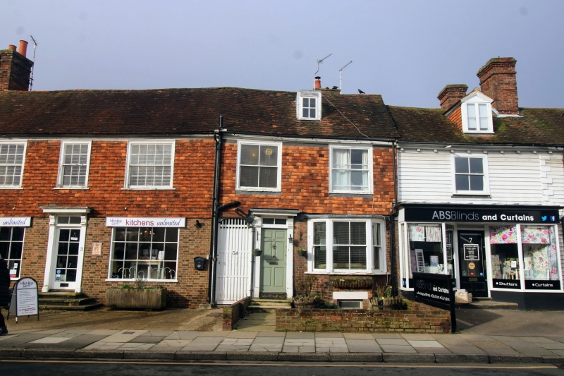
1.
1715 ASHFORD ROAD
(North West Side)
No 5
TQ 8833 1/91 8.5.50.
II GV
2.
C18. 2 storeys and attics. Ground floor brick, 1st floor tile-hung over
timber-framing. Tiled roof with 1 dormer. 2 sashes with glazing bars
missing. 1 later bay on ground floor. Simple doorcase with half-hood
and brackets.
Nos 1 to 13 (odd) form a group.
Listing NGR: TQ8857133583
External links are from the relevant listing authority and, where applicable, Wikidata. Wikidata IDs may be related buildings as well as this specific building. If you want to add or update a link, you will need to do so by editing the Wikidata entry.


Other nearby listed buildings
