Latitude: 51.2245 / 51°13'28"N
Longitude: 0.2311 / 0°13'51"E
OS Eastings: 555889
OS Northings: 149619
OS Grid: TQ558496
Mapcode National: GBR MNR.57J
Mapcode Global: VHHPZ.YHJ5
Plus Code: 9F3266FJ+QC
Entry Name: Limes Farmhouse
Listing Date: 19 February 1990
Grade: II
Source: Historic England
Source ID: 1070398
English Heritage Legacy ID: 179587
ID on this website: 101070398
Location: Watt's Cross, Tonbridge and Malling, Kent, TN11
County: Kent
District: Tonbridge and Malling
Civil Parish: Hildenborough
Traditional County: Kent
Lieutenancy Area (Ceremonial County): Kent
Church of England Parish: Hildenborough St John the Evangelist
Church of England Diocese: Rochester
Tagged with: Farmhouse
HILDENBOROUGH MILL LANE (west side) TQ 54 NE 5/153 Limes Farmhouse - GV II
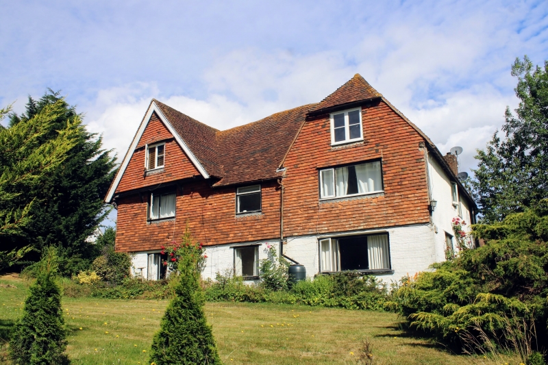
Former farmhouse. Circa mid C17, possibly with an earlier core; C20 alterations including refenestration. Framed construction, underbuilt in brick, painted white, first floor tile-hung on the front elevation, plastered on the north elevation; peg-tile roof; brick stacks.
Plan: The house faces east and is an approximate U plan with 2 parallel blocks on a west-east axis with a linking block at right angles between them. The details of the plan form and development of the building were unclear on survey (1988) as access to the interior was not available. The south block external detail suggests a mid/late C17 date but the north block may be earlier.
Exterior: 2 storeys and attic. Almost symmetrical 3-window front, the south block gabled to the front at the left, the north block roof half-hipped to the front at the right. The south block gable is jettied with a richly-moulded stopped C17 bresummer on brackets. All the windows are C20 plate glass casements in enlarged openings. The base of one wall post is visible on the front elevation and there is some exposed framing at ground floor level on the right (north) return, which also has C20 casement windows. The north block has 2 C20 stacks. A 1957 photograph in the National Monument Record shows that an axial stack has been removed from the front block.
Interior: Access unobtainable at time of survey (1988).
An interior inspection might necessitate revising the suggested dating and there may be interior features and a roof construction of interest. An internal inspection should precede any application for alterations to ensure that interesting internal features, including the possibility of an early roof, are not disturbed.
Listing NGR: TQ5588949619
External links are from the relevant listing authority and, where applicable, Wikidata. Wikidata IDs may be related buildings as well as this specific building. If you want to add or update a link, you will need to do so by editing the Wikidata entry.


Other nearby listed buildings