Latitude: 51.3068 / 51°18'24"N
Longitude: 0.3978 / 0°23'52"E
OS Eastings: 567234
OS Northings: 159136
OS Grid: TQ672591
Mapcode National: GBR NPB.5D3
Mapcode Global: VHJM4.VF52
Plus Code: 9F32894X+P4
Entry Name: Church of St Martin
Listing Date: 25 August 1959
Grade: II*
Source: Historic England
Source ID: 1070477
English Heritage Legacy ID: 179380
Also known as: Saint Martins Church, Ryarsh
ID on this website: 101070477
Location: St Martin's Church, Ryarsh, Tonbridge and Malling, Kent, ME19
County: Kent
District: Tonbridge and Malling
Civil Parish: Ryarsh
Traditional County: Kent
Lieutenancy Area (Ceremonial County): Kent
Church of England Parish: Ryarsh St Martin
Church of England Diocese: Rochester
Tagged with: Church building
RYARSH CP CHURCH ROAD TQ 65 NE (south side) 7/204 Church of St Martin 25.8.59
- II*
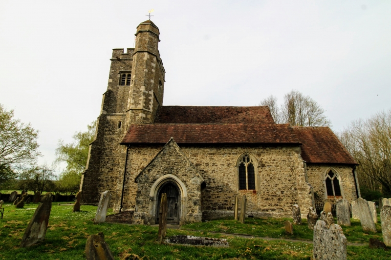
Church. C12 and C15. Tower, nave, south aisle and chancel. Kentish Ragstone. 3 stage crenellated tower with diagonal buttresses and prominent octagonal south- east stair turret, taller than the tower, with a pyramidal tiled cap. Late C14 west windows, wide with 3 lower lights and cusped lights above. 2 bay nave with C14 south arcade on octagonal pillars with hollow chamfered arches. C15 aisle walls, showing that aisle was probably widened at that time. C12 nave and chancel with small contemporary windows in north side of both. Wide hollow- chamfered chancel arch. INTERIOR: Timber truss roof in chancel. C12 piscina with scalloped bowl and moulded rim. Later C19 fittings.
Listing NGR: TQ6723459045
External links are from the relevant listing authority and, where applicable, Wikidata. Wikidata IDs may be related buildings as well as this specific building. If you want to add or update a link, you will need to do so by editing the Wikidata entry.


Other nearby listed buildings