Approximate Location Map
Large Map »
Latitude: 51.2672 / 51°16'2"N
Longitude: 0.3767 / 0°22'35"E
OS Eastings: 565900
OS Northings: 154692
OS Grid: TQ659546
Mapcode National: GBR NPQ.D2R
Mapcode Global: VHJMB.GDZW
Plus Code: 9F32798G+VM
Entry Name: 183, Butchers Lane
Listing Date: 19 April 1985
Grade: II
Source: Historic England
Source ID: 1070715
English Heritage Legacy ID: 178864
ID on this website: 101070715
Location: Herne Pound, Tonbridge and Malling, Kent, ME18
County: Kent
District: Tonbridge and Malling
Civil Parish: Mereworth
Traditional County: Kent
Lieutenancy Area (Ceremonial County): Kent
Church of England Parish: Mereworth St Lawrence
Church of England Diocese: Rochester
Tagged with: Building
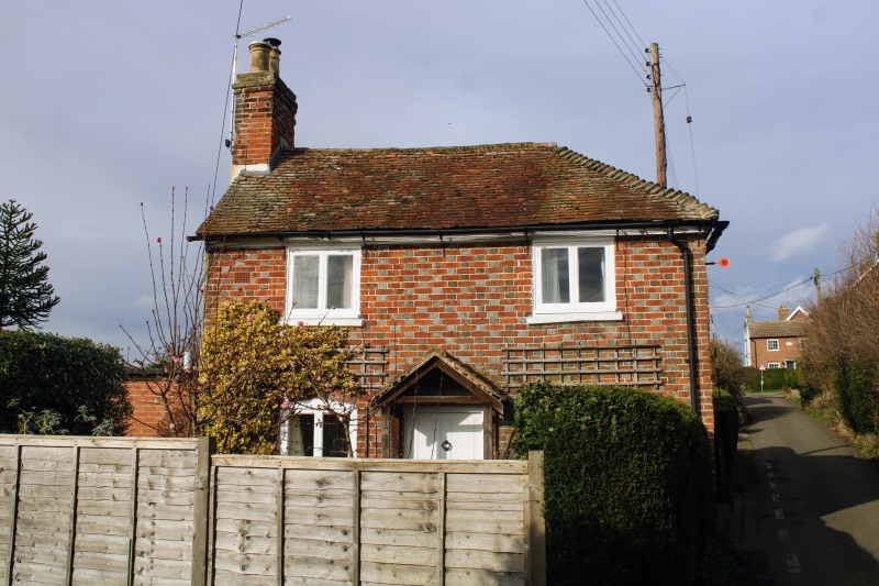
TQ 65 SE MEREWORTH BUTCHER'S LANE
(west side)
2/4 No 183
-
GV II
Late C18 cottage. Red brick with grey headers. Plain tiled roof, hipped
to east, with end stack to left. 2 storeys, 2 windows, casements. Central
hooded door. Ground floor openings segment-headed.
Listing NGR: TQ6590054692
External links are from the relevant listing authority and, where applicable, Wikidata. Wikidata IDs may be related buildings as well as this specific building. If you want to add or update a link, you will need to do so by editing the Wikidata entry.


Other nearby listed buildings
