Approximate Location Map
Large Map »
Latitude: 51.116 / 51°6'57"N
Longitude: 0.7403 / 0°44'25"E
OS Eastings: 591894
OS Northings: 138761
OS Grid: TQ918387
Mapcode National: GBR RWX.VCD
Mapcode Global: VHKKR.S67T
Plus Code: 9F324P8R+94
Entry Name: Royal Standard Public House
Listing Date: 10 October 1980
Grade: II
Source: Historic England
Source ID: 1070805
English Heritage Legacy ID: 180588
ID on this website: 101070805
Location: Ashford, Kent, TN26
County: Kent
District: Ashford
Civil Parish: Bethersden
Traditional County: Kent
Lieutenancy Area (Ceremonial County): Kent
Tagged with: Pub
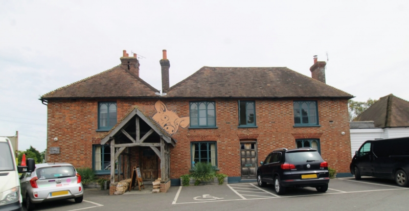
1.
5272 BETHERSDEN ASHFORD ROAD
Royal Standard Public House
TQ 93 NW 18/86
II
2.
Early C19. Two storeys red brick with grey headers. Hipped tiled roof. Four
Gothick - headed casements.
Listing NGR: TQ9189438761
External links are from the relevant listing authority and, where applicable, Wikidata. Wikidata IDs may be related buildings as well as this specific building. If you want to add or update a link, you will need to do so by editing the Wikidata entry.


Other nearby listed buildings
