Latitude: 51.0804 / 51°4'49"N
Longitude: 0.7718 / 0°46'18"E
OS Eastings: 594242
OS Northings: 134887
OS Grid: TQ942348
Mapcode National: GBR RXJ.3YL
Mapcode Global: FRA D6H8.JG9
Plus Code: 9F323QJC+5P
Entry Name: Old School House
Listing Date: 16 August 1962
Grade: II
Source: Historic England
Source ID: 1070831
English Heritage Legacy ID: 180540
ID on this website: 101070831
Location: Woodchurch, Ashford, Kent, TN26
County: Kent
District: Ashford
Civil Parish: Woodchurch
Built-Up Area: Woodchurch
Traditional County: Kent
Lieutenancy Area (Ceremonial County): Kent
Tagged with: House
WOODCHURCH FRONT ROAD 1. 5272 (west side) No 12 (Old School House) TQ 9434 22/504 16.8.62. II GV
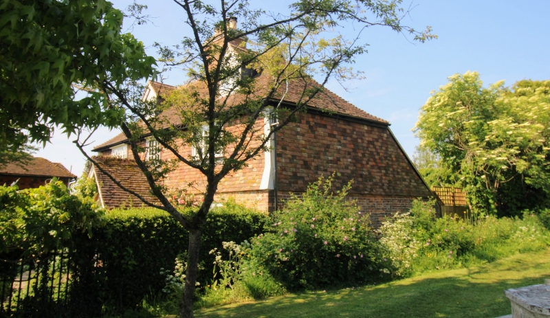
2. Cl7 or earlier timber framed building on a base of stone rubble, refaced with red brick on the ground floor and tile hung above with a slight projecting base between. Two storeys and attics. Hipped tiled roof with 2 gabled dormers. Three casement windows. C19 gabled porch. Pavement of Bethersden marble in front of house.
Listing NGR: TQ9423834889
External links are from the relevant listing authority and, where applicable, Wikidata. Wikidata IDs may be related buildings as well as this specific building. If you want to add or update a link, you will need to do so by editing the Wikidata entry.


Other nearby listed buildings