Latitude: 51.0141 / 51°0'50"N
Longitude: 0.7085 / 0°42'30"E
OS Eastings: 590085
OS Northings: 127347
OS Grid: TQ900273
Mapcode National: GBR QWW.CYD
Mapcode Global: FRA D6CF.PVF
Plus Code: 9F322P75+JC
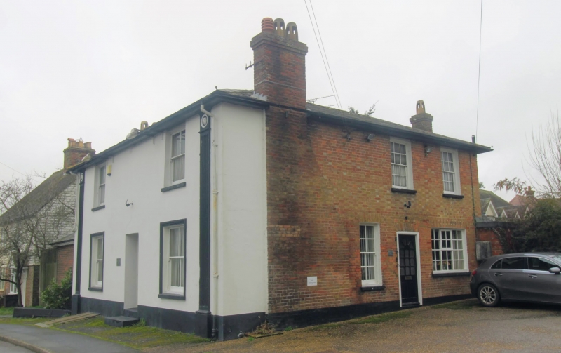
Entry Name: The Ewe and Lamb Inn
Listing Date: 9 August 1979
Grade: II
Source: Historic England
Source ID: 1070850
English Heritage Legacy ID: 180482
Also known as: The Ewe and Lamb Inn, Tenterden
Ewe and Lamb Inn
ID on this website: 101070850
WITTERSHAM STOCKS ROAD 1. 5272 The Ewe and Lamb Inn TQ 92 NW 13/438 II
2. Early C19. Two storeys stuccoed. The front is flanked by grooved pilasters with masks in the capitals. Hipped slate roof with wide eaves cornice. Two sashes with glazing bars missing.
Listing NGR: TQ9008527347
External links are from the relevant listing authority and, where applicable, Wikidata. Wikidata IDs may be related buildings as well as this specific building. If you want to add or update a link, you will need to do so by editing the Wikidata entry.


Other nearby listed buildings