Latitude: 51.1486 / 51°8'54"N
Longitude: 0.8721 / 0°52'19"E
OS Eastings: 600974
OS Northings: 142735
OS Grid: TR009427
Mapcode National: GBR RWP.Z5Z
Mapcode Global: VHKKN.2DDB
Plus Code: 9F324VXC+CR
Entry Name: Talbot House
Listing Date: 24 September 1951
Grade: II
Source: Historic England
Source ID: 1071117
English Heritage Legacy ID: 179907
ID on this website: 101071117
Location: Ashford, Kent, TN23
County: Kent
District: Ashford
Electoral Ward/Division: Victoria
Parish: Non Civil Parish
Built-Up Area: Ashford (Ashford)
Traditional County: Kent
Lieutenancy Area (Ceremonial County): Kent
Tagged with: House
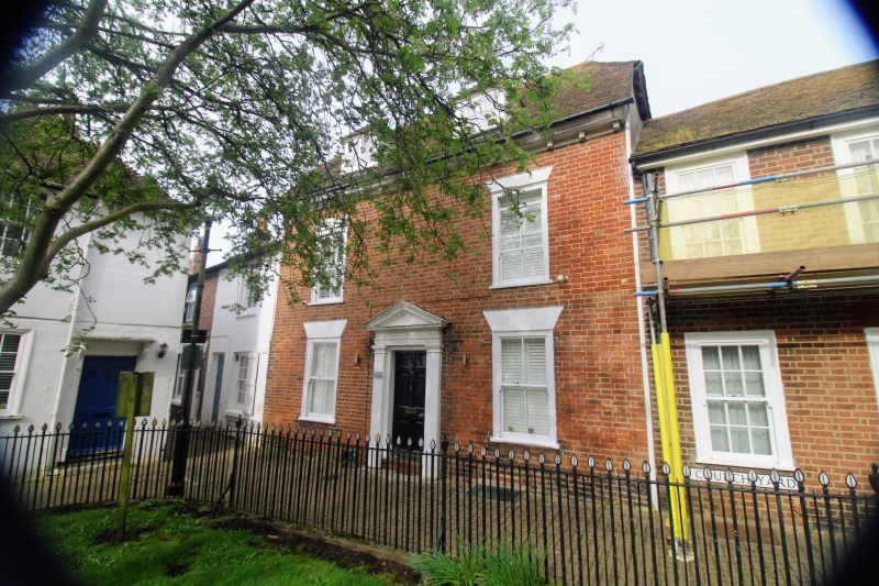
1. 5344 THE CHURCHYARD (West Side) No 13 (Talbot House) TR 0042 NE 2/46 24.9.51. II GV 2. C18. 2 storeys and attics red brick. Half-hipped tiled roof with 2 hipped dormers and wooden modillion eaves cornice. 2 sashes with verticals only. Doorcase with pilasters, pediment and 6-panel door, the top 2 panels cut away and glazed.
All the items in the Churchyard form a group, together with Nos 51 to 61 (odd) 61A, 63 to 67 (odd). 67A, 69 to 71 (odd). 75 and the rear part of No 75 High Street.
Listing NGR: TR0097442735
External links are from the relevant listing authority and, where applicable, Wikidata. Wikidata IDs may be related buildings as well as this specific building. If you want to add or update a link, you will need to do so by editing the Wikidata entry.


Other nearby listed buildings